Day 0: 14 March, 0.0 miles today, 0.0 miles total, Tucson, AZ
Waiting at the sparsely populated gate for the first leg of my flight to Arizona to board, I was started by an explosion of Kelly Clarkson being played at full volume from a speaker clearly not design to sustain that volume for long. I suppose if someone functions under the assumption that everyone else wants to hear the inane drivel spouting from their phone their just as likely to do so at six in the morning as any other time of day, but the experience was jarring, shattering the calm that the city of Atlanta had so deliberately created in Hartsfield-Jackson International Airport terminal T, with its soothing dark blue carpet and continual burbling stream of dental office jazz. I briefly made eye contact with a young woman sitting across from me, who’d been just as started by the sudden burst of outdated pop as I’d been. We shared a brief look, translating something like some people, am I right? and for a second I wondered if maybe after 42 years of debilitating social awkwardness I had suddenly become normal.
I was traveling, once again, from my parents’ home in Georgia to Tucson, and in fact much of my time in the airport was freighted with a sense of déjà vu for the start of my CDT thru-hike the year before. This time, however, I’d go no farther than Arizona: the shuttle from Tucson would take me south, within a mile of where the Arizona Trail meets the Mexican border, and, simple as that, I’d be on my own, walking north. I would start this trip alone—Sean Meadow had hiked the first 100 or so miles five years before and had no interest in revisiting the southern 2/3 of the state. She would join me for the 250ish miles north of Flagstaff, but the first 500+ miles would be up to me. This wouldn’t be the first hike I’d undertaken by myself, but unlike the PCT or the AT, I wasn’t sure I could count on finding people to hike with along the way. It was entirely possible that I could be almost completely alone for the next month. And if not, well, then I would have to rely on the social acumen I’d apparently picked up while waiting for flight 1434 to board.
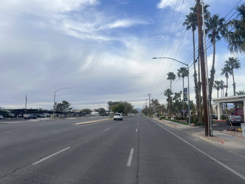
The Arizona trail begins at the border between the US and Mexico and skirts the edge of the Sonoran Desert as it wends its way north, crossing some 5 different mountain ranges before crossing the Grand Canyon and eventually terminating at the states northern border with Utah about 790 miles later. Compared to any of the triple-crown trails in terms of length, the AZT looks like a cakewalk, just a little wee baby of a hike, and it can be tempting for a hiker with experience on any of the longer trails to approach it as such. I am a big dummy in many ways—I had, in fact, approached the PCT with that kind of hubris the year after thru-hiking the AT, much to my sorrow—but am nonetheless capable of learning the occasional lesson from past mistakes. The two hard-earned truths to which I’d eventually had to submit in Southern California were that no thru-hike is quite like any other, and that desert hiking is no joke. 790 miles may not be 2,000 miles, but it’s still quite a lot, and the broiling, merciless, unshaded sun that beat down on me once I’d finally landed in Tucson and started wandering around in search of a decent taqueria nurtured only the spiniest, sharpest, and most venomous varieties of life. The desert is never gentle; it simply has never learned how. Gentleness is a luxury that grows in the shade.
Whatever waited for me under the broad, open sky, I would find it soon enough. For the moment, it was enough to hole up in my pricey, air conditioned, too-plush hotel room by the airport, and write emails while the marathon of The Office reruns you can somehow always reliably find on cable TV played in the background. In the morning, the walking would finally begin.
Day 1: 15 March, 8.2 miles today (not counting 3.4 mile approach to Southern Terminus), 8.2 miles total, Miller Peak Wilderness
My first day in the desert, it rained.
It came throughout the day in little fits—a flurry of drops for a couple minutes, then nothing for hours but wind. The wind has been constant since I dropped down to the border to stick my shoe through the barbed wire fence and “set foot” in Mexico. The 3.4 mile approach was twice as long as I’d expected, since the shuttle driver dropped me off at 0800 at the Coronado National Monument visitors’ and drove off after telling me that their shuttle would take me the rest of the way to Montezuma Pass. As it turned out, that shuttle runs every day of the week but Wednesday.
An extra 1.7 miles is an annoyance, but not the end of the word, and after I’d stamped up to the ridge above the border it was pretty easy going. I was just starting to wonder if I was ever going to see another soul on this trail for the next 50 or whatever days, when a trio of young, thin, fast hikers came bounding up from the obelisk marking the trail’s end. I was most impressed by their enthusiasm, which help me remember why any of us were out there at all. I talked the one in front for a couple of minutes, but it was the one bringing up the rear who really made me smile. “It begins!” he yelled as he chugged on by.
From the barbed wire border, the AZT shoots straight up Miller Peak, a hulking pyramid reaching over 9,000’ into the sky. Having spent basically all the last 6 months at or near sea level, it was an adjustment to be suddenly working hard well over a mile into the atmosphere. I was really looking forward to the downhill walk waiting for me in the other side, but as it turned out that half of the mountain was still covered in snow, which slowed my progress enormously as I post-holed over and over—eventually losing my shoe and having to dig it out. I’d forgotten how tightly I need to cinch my laces while hiking.
The snow lasted for the better part of two miles, and after a while I started to question the whole damned endeavor. What the hell was I doing out there? I had no idea, but also no alternative. That’s kind of the thing about thru-hiking: whenever the trail is dangerous, or painful, or scary, or confusing, or difficult, or just annoying, the only way out is always through. You’re stuck with it until you’re done.
That stretch was only uncomfortable and slow. I made camp shortly after it making it clear of the snow, even though it was still an hour and a half before sunset—and sunset would come early, since AZ doesn’t participate in daylight savings. Whatever. At least I was sheltered and starting to warm up a little as the night’s long rainfall starting pinging the walls of my tent.

Day 2: 16 March, 20.4 miles today, 28.6 miles total, Coronado National Forest
It rained all night, without a pause. I noticed because, as it turned out, the site I’d selected to pitch my tent was a great more slanted than I’d first thought, and I spent the night bunched in the corner due to the domineering influence of gravity. I wasn’t aware of it at the time, but while I was rolling over continuously, trying to find a tolerable position, pressure from my sleeping pad was deforming the tent in such a way that runoff from the walls was dripping into the tent. I figured this out in the morning, when i picked up my pack—which I had stowed inside to keep it dry—and discovered a large pool of water taking up and entire corner.
I’d slept (or dozed) in an extra hour in the hope that the rain would abate before I’d have to deal with it in person, but to no avail. Suiting up for the weather in a wet tent on a steep angle full of standing water is an awkward endeavor, and by the time I was out in the freezing, wet air, I was already properly annoyed about pretty much everything. I threw all my gear into my pack, trying to keep the wettest pieces separated from the merely damp pieces by using the pack liner, but by the end things were getting thrown in Willy-nilly. After a quick, joyless breakfast, I started on my way.
The day got better almost immediately, the raining stopping after I’d gone only a quarter mile. I suspected the weather would only get better as I lost elevation, so I plowed forward until I was finally off Miller Peak. It was still overcast, but at least I was out of the clouds and the wind had thankfully died down. As I rambled through the rolling countryside, the sun started fighting to break through the cloud cover, finally making an appearance in the late afternoon. I considered stopping to dry out my gear, but figured the smartest move would be to get to camp as fast as possible and let everything dry there. It would have been a brilliant plan if the clouds hadn’t returned before I got to a decent stopping point. I nonetheless spread everything out all over the campsite in the hopes that I could everything at least a little less wet, if not properly dry, and it did seem to be working before it suddenly started raining on all of my exposed gear. In a panic, I threw everything into the still-moist tent, and then followed it inside. It wasn’t the end I’d hoped for the day, but at least my tent site was flat.

Day 3: 17 March, 21.0 miles today, 49.6 miles total, Patagonia, AZ
The person in the only other tent had said “hello” as I’d walked in, and I’d greeted her in return but fell silent when she didn’t say thing further. So, she wasn’t very sociable, I figured. I was wrong.
In the morning as I was eating breakfast, she started talking as if we had ever said more than literally one word to each other. “Man, I slept so good last night. I wasn’t expecting that or I might have set an alarm. I can’t believe I slept this late!” We chatted while I tried to brush my teeth, half-shouting over the big bush that separated our tent sites. Eventually she got tired of sort of yelling. “I’m coming over,” she told me.
I was spitting a mouthful of rinse water as she walked up; the first thing I noticed about her physical self was her pants: insulated down, like a puffy jacket for the legs. I’d already been thinking that it was possibly already too warm to still be wearing my coat, but she was dressed in down head to toe. The baffling in her pants gave her legs the appearance of the exaggerated musculature of comic book superheroes. I’m sure she was warm and comfortable in those things, but man they looked goofy.
She was from Canada, with an accent subtle enough that I didn’t pick it up until after she told me that fact. The conversation was a bit hard for me to follow, as she kept talking about distance in kilometers, and I kept fumbling the conversion in my head. She was very friendly, very nice, and I only realized after I’d wished her a good day and started hiking that she’d told me she was doing 10ish miles per day (or 17K, as she said). I would probably never see her again.
Nor did I see much of anyone else. The previous two days I’d run into other hikers at least every couple of hours, but after a couple encounters around midday I didn’t see a soul. The trail, which had been lush, green, and beautiful all morning, turned to dark, twisted chaparral and dry grass, with deviously curled thorns overhanging the path, which somehow made me feel lonely. I got lost for a while when I followed a trail marker which clearly pointed to the right, realizing only a half mile or more later that I should have gone left. Wandering around the intersection, it took several long minutes to discover the real trail, buried as it was under hundreds of piles of cow shit.
After a shortish road walk—the first of the AZT, and one which distinguished itself my the discover of a colony of fire ants that seemed to have burrowed terrifyingly straight through the asphalt—I found myself at a sort of thru-hiker camp ground in the backyard of a pleasant, gray-haired woman. I’m never extremely enthusiastic about paying to sleep in someone’s yard, but it was cheaper than any hotel would be, and had all the amenities a hiker could need. I borrowed one of the loaner bikes and rode into town as the sun finished setting, a hot cooked meal the only thing on my mind. “AZT Gateway Community” or not, it was clear that the locals still weren’t very familiar with the trail that ran right through their town: the waitress at the restaurant I went to for dinner was vey nice, but was nonetheless confused at the amount of food I’d ordered for a single person.

Day 4: 18 March, 16.5 miles today, 66.1 miles total, Coronado National Forest (specifically, the foothills of Mt. Wrightson)
The night in Patagonia was the coldest one yet, by far. Bundled up in my puffy, base layer, sleeping bag liner, and quilt, I nonetheless had trouble sleeping because of the chill. True, I could have re-fashioned the quilt so it was wrapped around my inflatable pad to keep out drafts (as it was actually designed to be used), but I wasn’t quite uncomfortable enough to put that much energy into fixing the problem.
In the morning I showered on a converted porch, using a shower head that came no higher than my chest and went to the RV park next door to do laundry. By thru-hiking standards, my clothes really weren’t all that dirty, but I wasn’t sure I’d have the opportunity at my next stop, so I figured I should take advantage while I could. For breakfast I cooked up the last package of the fancy ramen I’d been cold-soaking on trail, and learned that that brand, apparently, requires heat to taste like anything other than chili powder and sadness. It was actually really good served hot.
Once everything was clean and packed up I walked to town and picked up supplies at what I’d thought would be a proper grocery store but was, in reality, a super overpriced convenience mart. I was able to cobble together a decent resupply—though the prices did lead me to ration my food for the next section a little more tightly than I might have. Afterwards, I stopped by the local Mexican place and got, I think, the smallest bean burrito anyone has ever paid $7 for. I was surprised, after the mountain of food I’d gotten the night before for under $20.
After lunch, I followed a dirt path through a field of chaparral next to the highway for 5 miles to get back on the AZT proper, at which point the trail started winding it way slowly toward the foreboding mass of Mt. Wrightson in the distance. While the drainage below climbed upward in a short, sweet, straight line, the footpath climbed slowly, slowly, slowly up along a series of endless ridges perched over the valley below like giant knuckles on a hand with 20 fingers. It was a fairly easy walk, but as I was carrying water for 17.5 miles, plus an extra liter for camp, my pack was the heaviest it had been thus far. As the sun started to take on its evening cast it was time to find a place to camp, but even after rounding a bend and starting an equally long decent, mile after mile after mile went by without a suitable place to sleep.
In the end, I made camp on an exposed ridge—exactly the sort of place I’d avoid if I wasn’t quickly loosing daylight. The views from sites like this tend to be stunning—and this was no exception, though in my rush to pitch my tent I pretty much missed the sunset—but they also tend to be windy and cold and usually make for terrible camping. I could keep going for hours into the dark without finding anything better, so I stopped for the night. I hadn’t seen anyone in hours—certainly no hikers who’d been headed in my direction—and I felt completely, utterly isolated, in these unknown Arizona mountains, without even the comfort of a stranger’s tent to keep me company.

Day 5: 19 March, 21.5 miles today, 87.6 miles total, Coronado National Forest
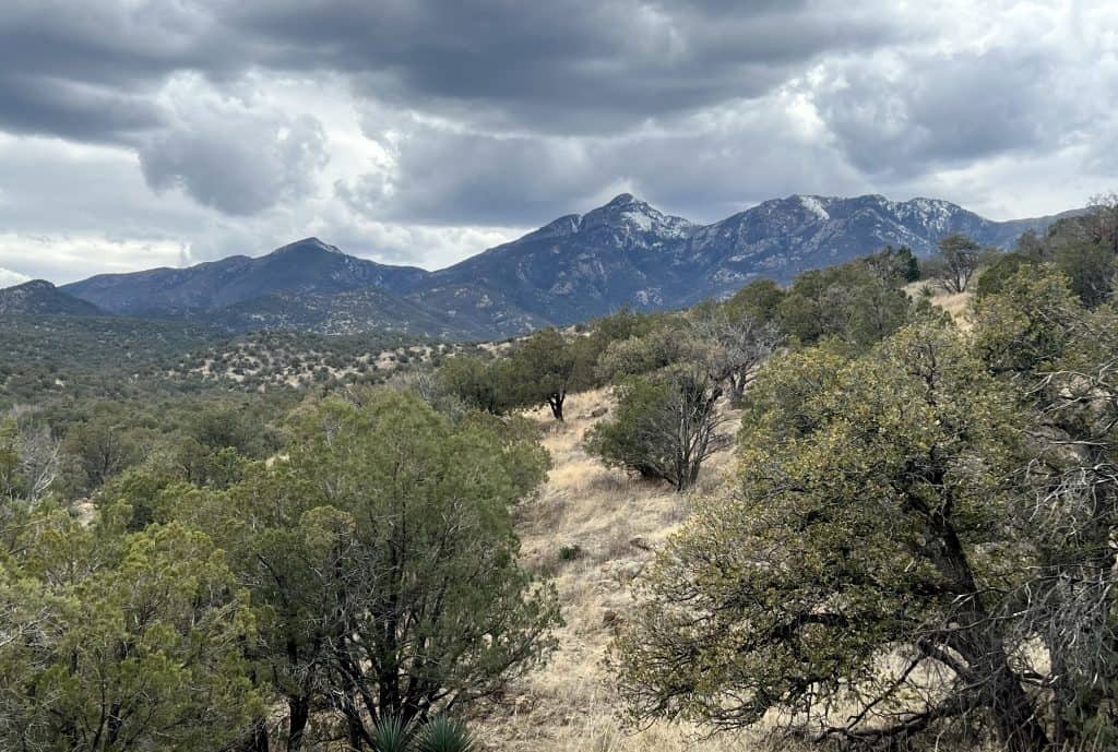
The term “mountain” has a specific, technical definition, some set of metrics that distinguishes one from a hill, mound, down, or knoll. I am not sure what those numbers actually are, but there is another definition, one which manifests itself physically within the human body. You know you’re on a mountain when you’ve been climbing hard, hard, hard for seemingly as long as you can remember before coming to the realization that you’ve only made it halfway to the top. After Miller Peak’s birth by fire at the start of the AZT on day one, I hadn’t had to contend with another before tackling the lushly forested Mt. Wrightson late this morning. It was a tough workout, but it was also fun to have a challenge besides distance, and the view from the pass was worth the effort.
The rest of the day was just a pleasant walk through undulating savanna, watching the mountains in the distance grow larger throughout the afternoon. I barely saw any other people at all—which is odd for a weekend. I passed through several trailheads, but most were empty or had only one or two cars. For the second day in a row, I’d heard rumors from people I passed about other NOBO AZT hikers ahead of me, but I didn’t see any. I was thinking about the other big hikes I’d done, and how I had always been surrounded by other hikers of every description when I was solo, or otherwise had at least one partner while traveling through the more remote sections of backcountry. This trail is the most alone in the middle of nowhere I’ve ever felt, though I don’t know how true that actually is—you could hike a half-mile behind another person all day and never see them and never know it. But this countryside does just feel empty. I was pondering what this meant for the rest of the hike, when I passed a young man who was clearly a thru-hiker getting ready to cowboy camp for the night. We waved to each other as I continued down the dirt road we’d be following for a few more miles. I stopped shortly afterwards, having found a dispersed camping site sheltered from the mounting wind on most sides by trees. Good enough for me.
Day 6: 20 March, 21.6 miles today, 108.3 miles total, Coronado National Forest
The deep cold of the desert night takes hours to settle over the landscape—so even though I often went to bed feeling overdressed and overheated, the wee hours still occasionally found me shivering in my bag until I could wake up enough to seal off whatever draft was causing the problem. It also made getting up before dawn extremely difficult: even on mornings when I woke up naturally before the sun it was impossible to convince myself to leave my warm cocoon for the stark, freezing world outside my sleeping bag.
And so, while I’d planned on an early start for the day, I didn’t actually begin walking until the sun had been up for nearly an hour. I hadn’t only been hoping to make miles today—the cool of the morning is usually the best time of day to hike in the desert, and sunrises over the arid countryside are usually epic. So far, I hadn’t caught one since the day my shuttle left for the approach trail at 0620hrs.
It was, on the whole, a fairly unimpressive day. As Mt. Wrightson dwindled in the south, the landscape turned from endless rolling savanna to endless rolling cactus fields. The trail was rocky and uneven and dry, and every natural water source was already so low that they were almost 100% pure green algae—which looked neat, I suppose, if you weren’t planning to drink from them. I wasn’t, counting instead on a cow trough I blew right past, and then had to spend 20 minutes looking for. It was the gnarliest water I’d seen yet on the AZT, though doubtless it would not be the worst by the end of the trail. Still, it filtered easily enough and tasted better than the treated well water I’d picked up the day before when I passed briefly through Kentucky Camp, a charming little retreat whose gold-mining history was explained on a number of trail side signs I hadn’t bothered to read.
With clouds obscuring the setting sun, I decided to make camp at a highly cow-hammered pond, as the next likely site was still an hour’s walk (and was reported last year to have been infested with gear-eating kangaroo rats, which will destroy anything with sweat-salt on it, like shoes, trekking poles, and backpacks). I managed to find a flattish spot sheltered from the worst of the wind, which blew ripples across the pond as I mixed up a package of “fully loaded” instant potatoes and ate them cold.

Day 7: 21 March, 19.5 miles today, 127.8 miles total, Colossal Cave Mountain Park
In a desperate bid to get to the store at Colossal Cave before it closed—which, in addition to a wide variety of Arizona-themed trinkets, held my resupply box—I finally convinced myself to get up and moving well before sunup. While wrestling with my groundsheet especially in the wind and dark was an extra special pain in the ass, I was rewarded with my first spectacular sunrise on trail. I wondered briefly what it would be like to sit back and watch something like that while leisurely sipping a cup of coffee, but walking through an ornately painted landscape has it own unique charms, I suppose.
The quickly grew gray and cool, which actually made for pretty comfortable hiking. The morning passed pleasantly enough and before I knew it I was over halfway to the store and ready for lunch. Since I was about to re-up all my food, I was free to eat anything that remained in my bag—unsalted almonds, plain tortillas, and cracker crumbs for days. I sat for a few minutes and talked with a pair of AZT NOBOs, the first I’d spoken to since the day I got into Patagonia. I left the meal feeling happy and confident, and promptly got lost, following the wrong trail down a stream for half a mile. I actually realized my mistake well before the half-mile mark, but I was convinced I’d be able to reconnect to the AZT if only I could get around the mammoth rock cliff face between me and the trail.
Alas, no, I had to backtrack for a ways, but I did find a drainage I could climb up that wasn’t nearly as steep as the canyon walls I’d been wandering hopelessly down. A few sweaty, steep minutes and I was back on the proper path and suddenly surrounded by saguaros. I’ve always loved these cacti, which stand like childrens’ crayon drawings brought to life. They’re so awkward and giant and magnificent, and in a matter of minutes, there were hundreds of them in every direction. It was like walking into southwestern fairy tale.
I made it to the store with plenty of time as did several other hikers I’d never seen before. I was even able to charge my battery and my phone before the place shut dow—hopefully just enough to get me to the next place with a power outlet. I got my box, paid for a camp site, and ordered a Colossal Pretzel, which, true to its name, was the biggest bread twist I’d ever had the pleasure to encounter. Knowing that this was my last chance to wash anything for at least several more days, I scrubbed my face in the bathroom with that cheap soap that never quite washes out of your beard, and I could still smell it on my face hours later. The view from the stone building was actually quite nice, and we few hikers planned out the next few days as we ate prickly pear ice cream and waited for our phones to fill up.

Day 8: 22 March, 15.6 miles today, 143.4 miles total, Saguaro National Park
On a cattle gate somewhere in the broad expanse of the Coronado National Forest a sign was posted, saying something to the effect that in 30 miles, AZT hikers would hit the border of Saguaro National Park, and would need ti have entry permits and camping permit arranged ahead of time. The notice included a separate QR code for each—never mind that the cell service on that cacti’d slab of rock was uncooperative. But in a mile or so, my phone lit up with limited LTE, allowing me to first purchase the entry permit, then to discover that the only two camp sites anywhere near the trail in the park were booked through the end of the month.
After a flurry of wilderness-internet research, it was determined that the online reservation system was the only means offered by the Park Service for securing a site in Saguaro. It was later established that a single booking effectively “filled” the online campground, meaning that a single hiker on his own, like me, would effectively prevent anyone else from booking a spot in the same area on the same night, just by making his own solo reservation. It was just a trail rumor that, due to the uncertainty inherent in thru-hiking, people had booked several nights at once, just be sure they were covered whenever they arrived; however nobody I or other two guys I’d fallen in with for this section ever talked to actually had the permit for the camp we wanted to stay at on the day we would arrive.
This clusterfuck made the sign-on-the-gate’s statement to hikers that it was strongly advised not to attempt to cross the park in a single day all the more galling. Nobody really wanted to tackle the 6,000’ ascent, and then descent, in one day—but for most people, that was the only way to follow the rules. Which is why Ghost Sole, Freedom, and I decided, basically, to ignore them.
We’d camped at the northeastern edge of Colossal Cave Mountain Park, right where it reconnected with the AZT. The morning dawned gray and gloomy, the clouds flowing overhead seeming pool around Mica Mountain, the 8,668 obstacle toward which we were headed. The effect was unsettling—we were walking directly into this dark, ominous mass. Still, the air was pleasantly cool, and the forests of saguaro cacti kept me enthralled well into the park. There is something almost animate about them, something aware. Walking through a cluster of these giants is like walking through a crowd of impossibly tall humans, each silent, still, and staring at you. They kept in their strange, humbling company for much of the day, as I climbed and climbed and climbed into the mountain and up to the cloud that thinned every now and again but never cleared.
As the saguaro gave way to stunted, twisted bushes and trees, the temperature slowly fell. I crossed a bald patch of rock long enough to make me think, “god damn it, I’m going to lose the trail,” just before loosing the trail. I bushwhacked through some dense, hard to whack bush before eventually stumbling back onto the path, startling a pair of buck deer that were either juvenile, or else members of some smaller variety. I made it into camp well before 1500hrs. It was already freezing.
We pitched our tents and sat around waiting for the day’s permit holder, whoever that was. They never showed up. There was a group of college kids from Vermont working on some sort of project until May with semi-permanent camp set up at the site, but they were mostly out of the way. After I’d eaten the lion’s share of the almonds I’d packed for this stretch in an attempt to keep warm—thinking ruefully all the while of the full pound of almonds I’d found fand left behin) in the hiker box at Colossal Cave—a family of five came straggling in. First was the dad and a teenage daughter, who put up a couple of tents while waiting for rest to appear. When the mom, nine-year-old and older teenage daughter finally showed up, the dad pointed out my ukulele to her. I handed it over, and while she struggled to remember the chords and words, she nonetheless belted out a quick rendition of “This Land Is Your Land” (including the more subversive, socialist verses, which was impressive in its own right). Her voice was clear and confident. She sang well and she knew it.
Once she handed the uke back, I noodled quietly for a while, killing time until I could make my cold-soaked ramen and the crawl into my sleeping bag. Cold soaking usually sounds unpleasant to people who’ve never done it, but it’s usually no worse than any other variety of backpacking fare…unless the weather is cold. Then it’s fucking miserable. I’d grossly underestimated how chilly this trail was going to be. How long before I’d be able to stop paying for it?
