Day 0: 6 July
A spork is the quintessential example of something less than the sum of its parts. Part spoon and part fork, it does a piss poor job serving as either utensil, its bowl broken as it is by its tiny, ineffectual tines, which protrude stubbily from the thing like the comically short arms of a t-rex or the vestigial finger bones of a whale. Some people swear by them—while Sean Meadow and I overwhelming agree on most backpacking gear, with regard to this one instrument we have always been completely at odds. On a generous day, I can be glad that if the damned thing works for her, she’s got one at the ready; but truthfully I have always hated sporks with a dark and disproportionate passion.
As Sean Meadow and I were sifting through our various piles of hiking stuff, packing for our trip to Alaska, I discovered that I’d misplaced my trusty backpacking spoon—a long-handled titanium beauty that had reliably fed me for thousands of miles along the PCT, the CDT, the AZT, the LT, the BMT, and a dozen overnights and short traverses over the years. I was pretty sure I had just left somewhere at my parents’ house—where I also kept a spare—so I wasn’t inclined to buy a new one just for a few days’ worth of isobutane-heated meals. Sean Meadow’s offer to share her spork was sincere and well-meant, but still I had to suppress a shudder as I politely turned her down. Besides, sharing utensils in the backcountry would be a pain, and it would mean that we’d have to take turns eating at the end of a long, tiring day. I rummaged in the kitchen’s utensil drawer, found a plastic spoon leftover from some takeout order or other, chucked it in my pack, and called it good.
The trip had been set in motion by our friends, who had left the seasonal rotation of life in Antarctica and settled in the tiny tourist bubble of Talkeetna, AK—and had, ever since, been trying to convince Sean Meadow and me to come up and visit. The fact that it had taken us a couple years to get around to it was due more the logistics than a lack of interest. We’d both been to Alaska before and were excited to go back, but getting there from the lower 48 is neither easy nor cheap. When we finally found an opening in the summer calendar wide enough to allow a trip to the frontier state, we were fortunate enough to find that we had friends and family all the way from Anchorage to Fairbanks, every one of whom were generous with their time, their homes, and their discounts at certain lodges, as well as the Alaska Railroad.
In Anchorage we were treated to an unplanned day hike in the picture-perfect Chugach Mountains, that formidable wall of slate which slaps any newly arrived traveler to the Ted Stevens International Airport right in the face with the state’s natural grandeur the moment they walk off the airplane. A couple of days and one scenic train ride later, we were taken to the Talkeetna VFW and given tickets for the annual moose drop, a 4th of July tradition where some two thousand painted and numbered moose poops are hoisted twenty feet into the air and released over a target—the holder of the ticket matching the turd that lands closest to the bulls-eye being the day’s big winner.
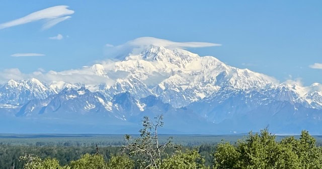
At night, as the summer sub-arctic sun hovered low in the sky without ever giving up all its light, we looked out from the lodge across the flat expanse of taiga forrest at Denali,1 2sitting impossibly tall and impossibly wide in the center of the panorama of the Alaska Range.
The train ride from Talkeetna to Denali National Park is a picturesque tour of natural splendor in its own right, with sweeping views of the mountains for most of the journey. We arrived at the park around midafternoon, and by dinner time we’d secured our backcountry permits for four days of wandering the park’s backcountry, picked up our bear cans and repacked our food into them, gotten our bus tickets for the ride out in the morning, paid for our one night of front country camping, found an empty site, and set up our tent. Probably we could have made our way back toward the overpriced cafeteria near the park entrance for something to eat, but I was perfectly happy to make myself a quick cupful of ramen at camp. I let the noodles soak for a few minutes in freshly-boiled water, gave them a quick stir with my plastic takeout spoon, and recoiled in horror when I saw how badly it had been deformed by just a couple of seconds in the soup.
Cleary the idea that had seemed so simple and elegant back in our kitchen was not going to hold up in the real world. I needed to find a better, less meltable solution for stirring (and eating) my meals, and quickly. The campground had a small store near the shower and laundry facilities, so I jogged over to see if I find a heatproof replacement. In less than 12 hours, we’d be on a bus heading into the wilderness, so I was effectively out of time and out of options. Whatever utensils were available at the Riley Creek Mercantile would have to do, at whatever price. I scanned the shelves three times over, but there was only one option, hanging on a peg beneath a small sign labeled $20. It was a lot of money for a single utensil, but what could I do? I sighed, shook my head, and headed to the register with my purchase:
A fucking spork.
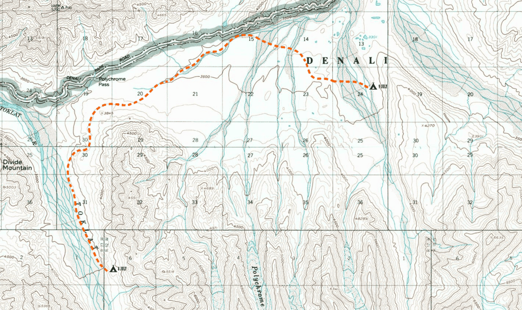
Day 1: 7 July, 8.5 miles hiked
Denali National Park and Preserve is immense. It comprises well over 6 million acres of pristine wilderness, its boundaries encompassing countless peaks and ridges across the spine of the great Alaska Mountain Range. These make up three distinct watersheds within the park alone, fed by over a dozen major rivers, and sprouting distinct ecosystems of thick taiga forest, gnarled brushland, swamp and muskeg, and rolling, meadowed tundra—all native habitat to caribou, dahl sheep, eagles, ptarmigans, grizzly and black bears, and absolutely tremendous colonies of mosquitoes. This massive natural playground is roughly bisected east to west by the park’s only road, a broad dirt track used by Denali’s fleet of shuttle buses and a few other vehicles driven by the contractors who work in the rolling scenery beyond the ranger station. The road is 92 miles long, with only one entrance, and no private vehicles allowed beyond the ranger station at mile 15. The park is so large that although the mountain which gives it its name lies within its borders, the closest point to which anyone could drive along the road is still over 30 miles away, as the magpie flies, from the highest peak in North America. Were you to hop a bus at the depot and take it to the last stop, the ride would take you some 4 hours, one way—most years, at any rate.
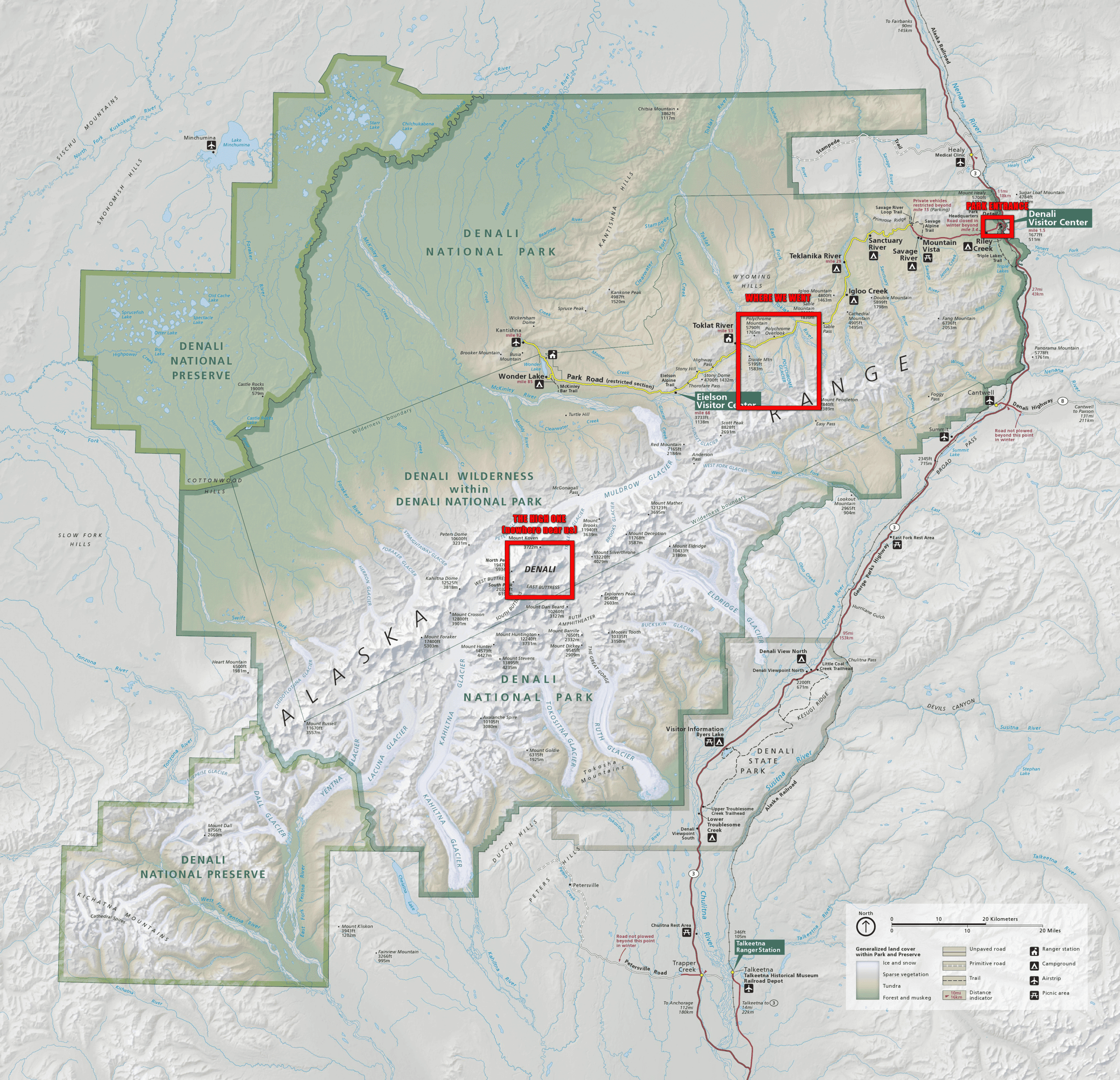
Click to enlarge.
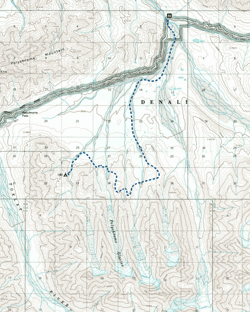
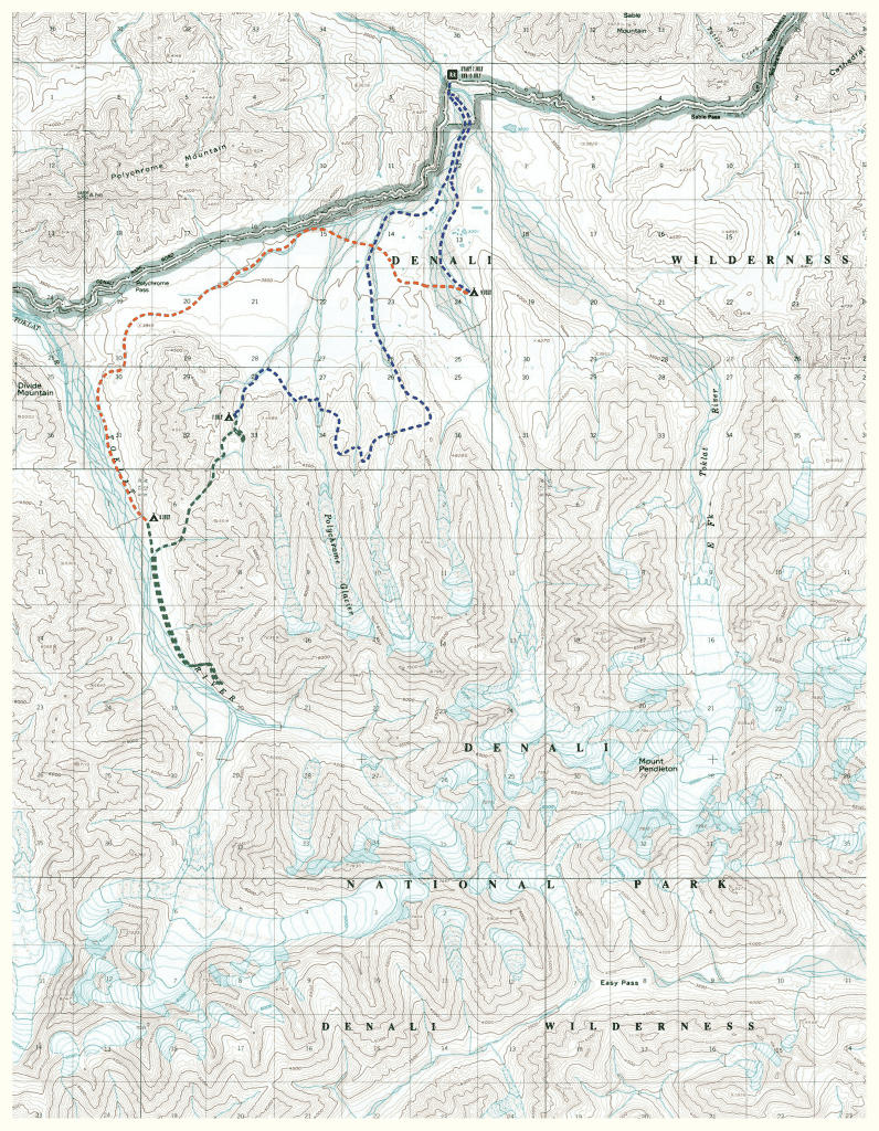
The year Sean Meadow and I went backpacking in Denali, the road was closed at mile 43, after the Pretty Rock Landslide had washed out a section of road some 200’+ above the meandering streams feeding the East Fork of the Toklat River. This had limited our options at the Backcountry Information Center in selecting where in the park we might wander, since the western half of the park was effectively closed to anyone without the cash to hire a bush pilot. But it just so happened that one of the areas we could go had been the long fingers of the Polychrome Glaciers, on the northern fringe of the Alaska Range, a captivating siren of multi-colored hills and steep black spires that had called to me maddeningly, endlessly, futility, across the brush and gravel, the only other time I had visited the park.
The ride out to East Fork, the temporary end of the road, was a 2-hour sightseeing tour of green, rolling tundra, rugged sawtooth mountains, and native wildlife. Denali bus drivers, even those as grizzled as ours—and even those on duty at 0630hrs—tend to be enthusiastic about their workplace. With only five riders on a vehicle in a vehicle made to hold 16 times as many, still we stopped to watch a moose graze on a hillside, a raven pull apart a mercifully dead vole and eat it, a pair of adult ptarmigans minding a brood of excited and bobbling young, a pair of caribou weaving in and out of the brush along the road, and a lone grizzly, seemingly foraging a hillside just a hundred feet from our window.
At 0900hrs, we were across the East Fork bridge, shoes laced snug, bear spray holstered at our hips, ready to walk the steps down from the road to the riverbed and begin our small adventure. Denali National Park regulates its backcountry in a unique way. The land is split into 87 units, each bordered by some natural feature like a river or a mountain range. These sprawling sections have quotas for how many people are permitted to camp every night in each—typically only 6 humans in a patch of land the size of many other parks. There are no trails, no signs or markers or blazes, no bridges or other infrastructure, no official routes of any kind. In fact, backpackers are told to cross the tundra side by side, to minimize how trampled the ground may be and discourage the growth of social trails through the unspoiled wilderness. You can pick a destination on a map, find a promising route to get there, and try to have a normalish sort of a hike—but, if you’re smart about it, you can also just follow wherever the mountains call you.
We walked the broad gravel bar below the road for an hour, crossing small braided rivers running fast and off-white with silt. These are fed by glaciers, which grind up the mountains as they flow and turn the streams that flow from them milky and densely opaque. These are joined occasionally by streams of clear snowmelt and rainwater, but these don’t do much to thin their chalky texture. The water is only just above freezing, and every footstep we took across one of these channels was an icy shock. By the time we we met another gravel bar running south into the mountains, we’d long left behind the day hikers who’d been out wandering the landscape—and the only other pair of backpackers who’d been on our bus had pushed on to get to their part of the park to the northwest. These were the last other humans we’d see until the we neared the road on our return on the last day. We were alone.
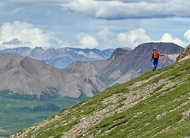
We followed the twisted, meandering waterway until we found ourselves in a valley, the rounded walls peppered thickly with willow and alder. As we pushed farther into the mountains, the gnarled shrubbery gave way to lush alpine meadow, and so we climbed onto the western ridge and made our way onto the mountains’s shoulder. The ground underfoot became spongy and soft, almost springy, and everywhere were tiny blossoms of vivid yellows, reds, and purples. There is a plant common to this kind of ecosystem, one I’ve never been able to identify, but whose pungent aroma defines the high ridges of western North America. It’s a rich, earthy scent with a sharp, bitter note at its edge. It’s an autumnal smell, calling to mind the deepest fall in the middle of summer. Whatever it is, it’s common in high places of the Cascade Mountains and a few corners of Rockies; places I hadn’t been in several years. I’d forgotten how much I loved that smell. We had lunch on a thickly carpeted rise, looking out at the mountains around us. The area is called the Polychrome Glaciers because of the many vibrant colors on display. Black stone head walls behind white masses of snow, rocks of burnt sienna and faded tan, slopes of yellow-tinged scree, multishaded grey ridgelines ranging from almost brown to almost blue, and shot through with bands of deep orange and red, a stark contrast to the deep green of the meadows.
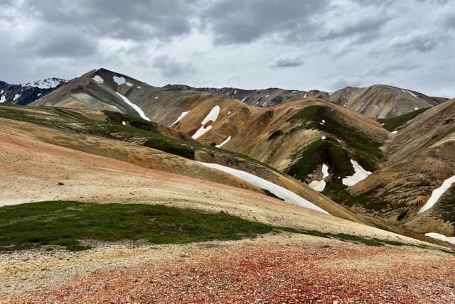
This was our backdrop as we began working our way toward the west, dropping down to the graveled cleft in each valley before climbing up the next ridge. The lackadaisical summer sun seemed to come out every time we set ourselves up a steep slope, and then hid behind a mask of cloud as the glacial winds nipped at us on the way down the other side. Eventually, we could see a gravel bar in the distance which would lead eventually into the long, secluded valley where we hoped to camp. It seemed like a straight enough shot through a bit of brush, but we soon found ourselves a wading through our first patch of muskeg. Willow caught our ankles as we tried to avoid stepping into bottomless pits of peat mud. We were scolded by a ptarmigan when we passed too close to her brood of chicks, but it was hard to even see them through the clouds of mosquitoes, grown so thick I couldn’t breath without sucking down two or three of them. We fought our way toward the gravel, popping out of the riverside brush like actors bursting through a velvet curtain and onto a massive, floodlit, empty stage.
We walked for a few minutes along the gravel bar just to give the light breeze enough time to shoo away the remaining mosquitoes that had trailed us out of the bog, then we set up to have a quick stream-side dinner before walking that last mile or so to camp. We sat facing opposite directions so we could keep an eye out for any bears that might be drawn to whatever we were cooking, and I looked back over the multi-hued ridges we’d trammelled across over this first day in the lonely open tundra.
The human world is small, and to navigate it our focus necessarily narrows. That isn’t in itself a bad thing, but when we spend too long fixated on the particulars we lose sight of everything that lies beyond our selves and the structures we’ve built to contain them. I thought back to something Sean Meadow had said, breathless at the top of a climb as we paused to take in the view: “These mountains make me feel so small.” And so they do, because we really are. Each one us of moves the world around us in profound ways that are imperceptible at close range, like a pebble that shifts one small part of the flow of a mountain stream, which over the millennia changes its course and thus the shape of the deep valley it eventually carves—but all we see most of the time are the pebbles, some of which look like insignificant grains of sand to us while others look like boulders. Some even pose as mountains themselves, casting dark shadows across the lives of others, but pebbles are we all. We just forget it, sometimes.
We’ve adapted to see the world in this way to survive it, but the psyche, the unconscious, the spirit, the soul, need to be reminded that we are a part of something so vast that the human mind can’t comprehend its size, its scale, or its limit—a mystery the full solution of which we can never know. We need to touch the things that remind us how small we are, to let them touch us in return. That moment, when we see how impossibly tiny we truly are, is also when we start to see how powerful we are, working to catch our breath as we gaze down the sweeping spine of a long climb we’ve just crested. Small as we are, insubstantial as shadows on the mountainside, frail and easily beaten by the elements, we nonetheless can carry ourselves to the peak on our own burning muscles, engines of purpose, machines of determination, rivers of dripping sweat.
If a mountain can be climbed, a tyrant can be overthrown.
Day 2: 8 July, 8.2 miles hiked
I awoke around 0400hrs to the sound of heavy rain. It had been sprinkling three or four hours earlier when I’d finally gotten around to pulling my all-purpose neck-gaiter/headband over my eyes,3 so I wasn’t terribly surprised. Oh well, I thought before nodding off once again. Guess it’s going to be a wet morning. But when I woke up for real around 0630, the sun was burning high and clear in a stunning blue sky. Still, some things had gotten a bit wet overnight, so we spread everything out across the nearby gravel bar and had a leisurely backcountry breakfast4 while it dried.
Before long, I had to run up into the brush to dig my morning cat hole. The Deuce of SpadesTM is the trowel carried by most every thru-hiker because it’s incredibly lightweight and reasonably cheap, but it can be a giant pain to use if the ground puts up any resistance. The entire thing is thin, sharp metal—including the handle—and making a hole in rooty and rocky tundra takes a bit of finesse. It took several arduous minutes before I had a hole I was happy with, and when I finally looked up I was surprised to see a Caribou not quite 200’ from where I was kneeling, alternately grazing and starting at me. I kept still and watched it for a while, the great swooping antlers slicing the air as it started making its way further up the valley. Then I finished my business and followed behind it, so Sean Meadow and I could pack up our gear and start the day’s wandering.
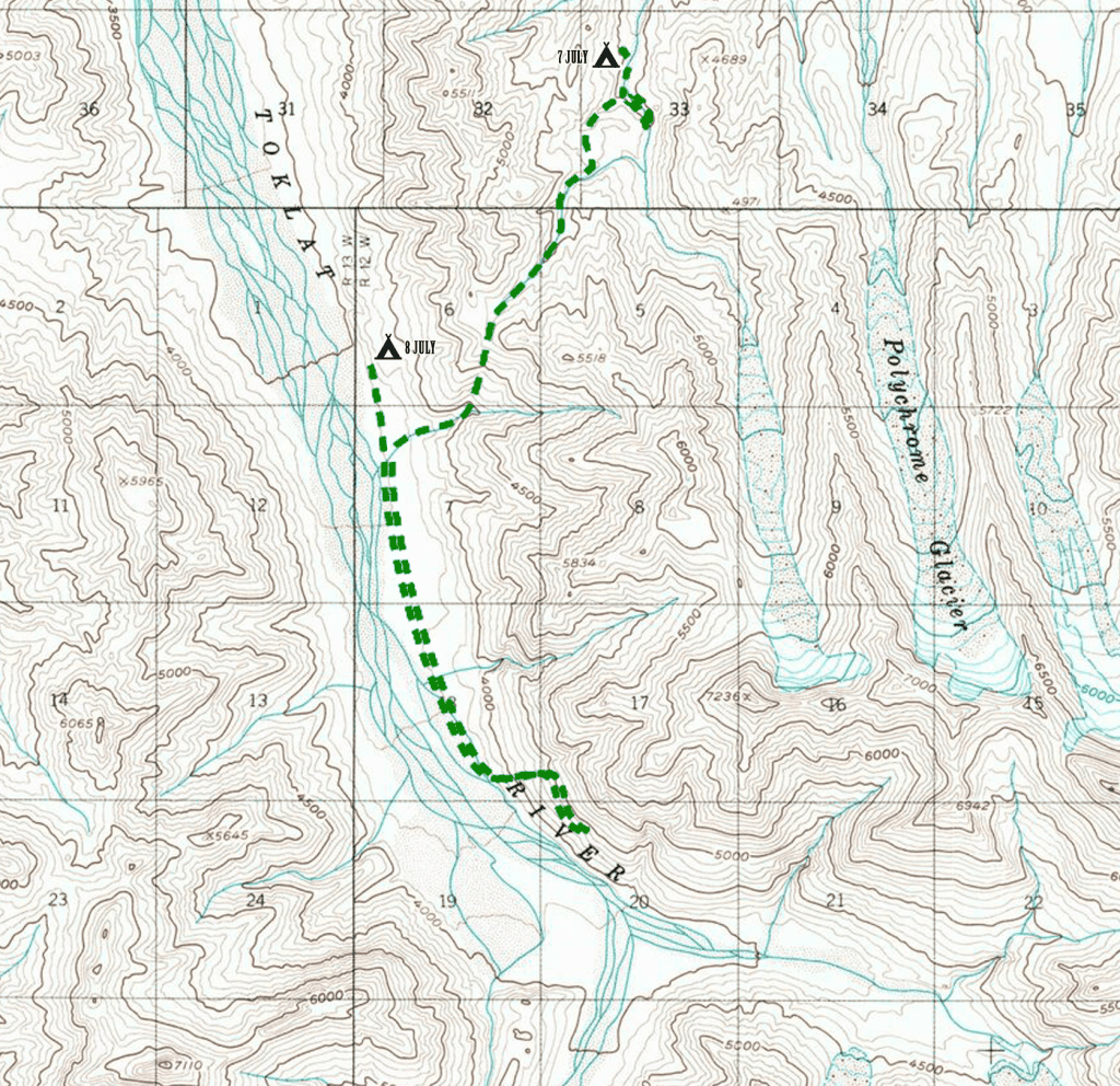
We were trying to find a route through the fat cluster of mountains to our west to the broad open valley beyond. We’d planned to follow the river running through the valley in which we’d camped until we came to an intersecting drainage that looked on the map like it would lead us to a navigable pass. But as we pushed higher into the mountain, the gravel bar narrowed until it disappeared completely, leaving only the milky, freezing water cascading forcefully between the steep slopes to either side. It was impossible to see how much farther it continued like that, so rather than wade god knows how far with sketchy footing, knee-deep in water that was only barely not ice, we turned back. We’d passed a smaller, rougher drainage which paralleled the one we wanted, and we hoped we’d be able to cross the ridge separating them a bit farther up without too much trouble.
We worked our way up the steep dirt cleft until we reach a small, pristine lake, whose shore we prodded until we found a way past up and onto the inviting green ridge beyond. Once up, we had a clear view of the towering mountaintop that crowned the valley’s back wall, and the massive open gravel bar below, like the plaza outside the gate of some monumental medieval castle. This was where the narrow channel of swift, freezing water we’d abandoned would have led only a little farther on, if we’d stuck with it. We crossed the meadowed ridge, finally dropping into the drainage we wanted by stepping/sliding down an unpleasantly steep and muddy bank. Now all we had to do was follow the alternating streams of water and snow to pass at the top.
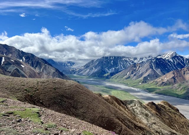
We hit it around noon, the marshy green carpet at the mountain’s top revealing more of the panorama before us with each step. The Toklat River valley is an immense flat gravel bar through which its namesake river braids for miles in both directions, bordered on each side by an equally imposing wall of giant mountains. It is a grand, foreboding place, still and sacred, terrifying and awesome in the most visceral sense. It is big and it is cold and it is dangerous, and I was trying to figure out whether the snow-capped peak I could see in the distance through a cleft in the rock was, in fact, the milky face of Denali5—its great bulk some 50 miles to the southwest—when Sean Meadow came up beside me. We stood in silence for moment, taking it in. As we considered our surroundings, a thought began to gather in my mind like the clouds over the distant peaks to the northwest. “So, uh…” I said, “how the fuck, exactly, are we going to get down there?”
I’d hoped for a way down the western face of the range we were on that would be comparably as easy as the way up the eastern side had been. But as we explored the pass, there just didn’t seem to be any. Sean Meadow spent a few minutes walking around and studying the terrain before beckoning me over to a small rock ledge, a sort of cantilevered balcony she’d perched herself on the far end of. “I think we can make it down that,” she said pointing at a nearby avalanche chute. “It’ll be steep and it’ll be uncomfortable, but if we go slowly I think it will be safe.” The fear of heights gets me on bridges and balconies and ladders and ledges, though I am almost always comfortable on mountains—but I did not like the look of that way down one bit. I spent some time pouring over the topo map, hoping to find an easier way down that might lay just out of sight, but it only confirmed what Sean Meadow had already said. If we wanted to go down this side of the mountains, this was likely to be the easiest, safest way. Once the decision was made, there was no point in waiting. We started down at once.
The worst part about the first twenty minutes was the view, which was glorious and expansive and was a constant, violent reminder that we were over 1,500’ above the valley floor. Staring down the route, with nothing between it and the wide open fall surrounding it on all sides, the fear found me, and all I could think was I can’t do this, I cannot possibly do this, even as my feet drove me inexorably forward. It was actually a kind of relief when we descended into the avalanche chute proper, since the narrow walls blocked off most of the view. But in another, more literal way, this was when the way became truly difficult to navigate. The ground to either side of the narrow stream were following down was a thick, gluey mud, slick and sticky, and which couldn’t hold the weight of a grown human. There were rocks in the steam, exposed by the current that built as we clambered down, but these were little better. Some held, but some gave way the moment I touched them, clacking loudly as they careened down the mountain, while others crumbled into useless shards in my hand. With no secure face to anchor any part of my body, it was a constantly-shifting, nerve-wracking puzzle trying to maintain three steady points of contact with the mountain while my handholds and footholds failed me one after the other, leaving me oftentimes with only one or two.
Safety is never guaranteed in the wilderness. People get hurt—sometimes badly—on established trails every day, so maybe the sense of security that comes from navigating a proven route is a false one. But whether it’s a reliable safety net or not, you sure notice it once it’s gone. I tried to steady my nerves and sharpen my focus by taking deep, regular breaths. When that didn’t work, I just kept repeating “Okay okay okay okay okay okay okay okay,” as each footstep held, and then “fuck fuck fuck fuck fuck fuck,” when it didn’t, while Sean Meadow interjected occasionally, “we’re getting there, you’re doing a good job, just keep it up.”
I fell only once, when my three point of solid contact narrowed to two, then one, before the rock in my left hand exploded into useless shards and left me sliding helplessly down the mud. The drop was all of two feet before I landed safely on solid rock, just a half-second of utter uncertainty and fear. I felt a twinge in my finger and looked down at the hand that had been holding the shattered rock, which has sliced me as I fell. I would find out later, when I had a chance to clean it, that the wound was actually quite small—but halfway down the chute it was putting out a truly disturbing amount of blood, until my hand was coated, my trekking pole was dripping with the stuff, and fingers kept sticking together. It didn’t matter. In the avalanche chute nothing mattered but the two of us getting safely down to the valley floor.
We paused when we finally came out of the long, muddy shaft and landed on a wide gravel slope that flowed the rest of the way down to the gravel bar through which the Toklat churns and pours. There was a Caribou, maybe 200’ downhill from us. Was this the same majestic specimen we’d seen in the morning before he’d vanished up the valley? Had we been following him all this way? We lost sight of him long before we reached the broad expanse of the Toklat’s pebbled floor. We’d seen hoofprints in patches of snow as we’d approached the pass, and others in dried puddles of silt, but most were old. Were those fresher prints his? Which way did he go? We never saw him again, though we spent the remainder of the day walking toward the hidden system of glaciers feeding the river behind the flanks of a pair of massive black pyramids far at the southern end of the valley. The ever-shifting view from the gravel bar was just as spectacular as it had been from above—but now elevated by the giddy relief that comes from having your feet planted firmly on the ground.
Day 3: 9 July, 10.1 miles hiked
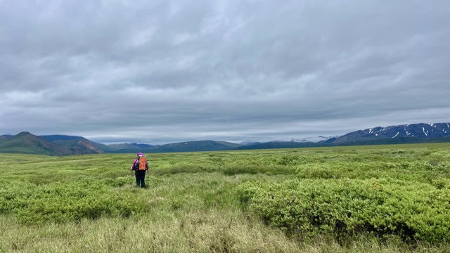
I had thought this would be an easy day.
I was, in fact, so sure that this would be an easy day that I was going to suggest to Sean Meadow that we have a late morning in the tent—and see whether the rain that had been falling all night might let up in the next hour or two—but just as I was about to open my mouth, Sean Meadow rolled over in her sleeping bag and exclaimed, “Shit! There’s water everywhere!” She was right. I hadn’t noticed, perched on my cush inflatable pad, but some quirk in the way we’d pitched our old CDT tent had allowed a steady drip of water to flow in at the corners and very slowly flood the interior. Our sleeping bags, most importantly, were still dry—perched as we both were on cush inflatable pads6—but most of the things we’d left on the floor were wet. There would be no lazing about in the tent that morning; in order to dry what we could, we’d have to pack up everything else and get dressed. And once that was done, we may as well just start hiking.
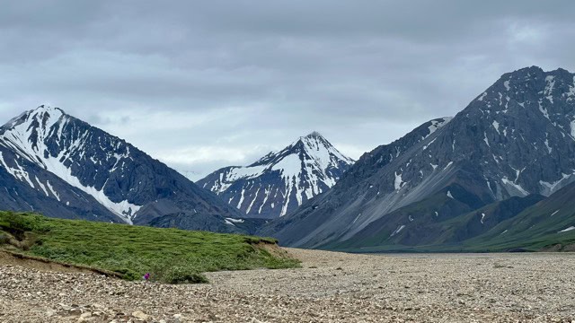
There was a light, cold wind as we started north down the valley. The rain came in waves, as layers of cloud shrouded the mountains to either side. Some people complain when the peaks are hidden behind these soft, undulating blankets, but weather is as much a part of the landscaper as sone or greenery. I’ve always loved the way mountains look half-buried in cloud, the way it defines each layer of the topography, and somehow makes these looming sentinels of the great mystery even more imposing, more brooding, more foreboding, like the sleeping gods they are. The tread along the wide gravel bar was easy and quick, though we stopped every so often to study footprints left in the silt—here a grizzly, there a wolf, and everywhere, caribou.
As we moved north, the gathering braids of the Toklat River fed into one another, becoming deep, roaring canals of water the color of heavily creamed coffee. Clearly, the muddy runoff was the rain was giving a bit of color to the roiling glacial melt. We kept toward the eastern side of the gravel bar, avoiding the most dangerous, swiftly moving channels, but the smaller braids we still had to cross required deliberation to manage safely—a night of rain had swollen the river and given it a temper, making it impossible to avoid. Membership in the Denali chapter of the Dry Foot Club is perennially zero.
We were planning to sweep around the northern flank of the mountains whose heart we had crossed the day before, hoping to keep mostly to a series of gravel bars almost the whole way. But soon the eastern bank of the Toklat became choked with willow and alder, and we expected the brush to only get worse the farther east we pushed through Polychrome Pass. So, rather than continue all the way to the low point between the range to our right and the cloaked, turreted mass of Polychrome Mountain ahead of us, we headed away from the river and straight up the brushy ridge, trying to avoid the worst of it.
It was slow, miserable going. The moment we left any given patch of high, thick brush we stumbled into another. The thick, intertwined branches at our feet snagged our ankles like bony hands trying to pull us down as we pushed through the stiff trunks holding back our legs and arms and bodies and faces. For the first time in the whole trip we didn’t have clear line of sight in every direction—now we could barely see where we were going most of the time—so we called out continuously to warn any hidden bears of our presence—no easy feat while marching uphill through a thicket of murderous shrubbery.
Every so often we made our way clear of the brush, only to find ourselves wading through wide patches of muskeg—mossy bogs shin and knee deep with cold ochre water and layers of moldering peat. Hummocks of swamp grass rose from the the frigid broth like pale green mushrooms, each appearing deceptively firm before squishing under our feet into the water. No matter how far we trudged, the ridge continued to rise ahead of us. Every time we thought we’d made it to the crest, all we could see was more ridge, more alder, more willow, more muskeg. We disturbed several families of ptarmigans, whose angry clucking I rather enjoyed as we hustled around their nest to give them some peace. But on the whole, the going was slow, cold, and after two solid hours we didn’t seem to be any closer to its end. The only blessing—besides the constant, spectacular scenery—was that the wind that kept our hides uncomfortably cold also drove off what would surely have otherwise been an absolute living nightmare of mosquitoes.
We posted up for a chilly lunch, speckled with occasional blasts of drizzle. Sean Meadow pulled off her sodden shoes and wrapped her feet inside a pair of plastic grocery bags she’s packed out for this purpose; not to keep her feet dry—it was far too late for that—but in the hope that the plastic layer would help trap a little bit of heat inside her shoes when she put them back on. Meanwhile, I studied our maps and tried to suss out the quickest way out of this mess, dispirited to see that if our hope was to avoid the presumable swampy floor of Polychrome Pass and continue over the ridge to the system of gravel bars on the other side, we were less than halfway across. We were sitting at the top of a drainage too small to find on the maps; it led down, and that was good enough. All we knew was that we wanted to get the hell off that blasted heath.
Almost as soon as we started down, the landscape before us opened up and we could see the twisted course of the river below, and our moods were instantly buoyed. The walking had been difficult, but it was not knowing how much more of it we had to endure that was really killing out morale. As we dropped in elevation, we left the thickest, wettest, and highest of the brushland behind, and our spirits rose as we flew toward the river, rushing towards us with each step.
Once down, we passed a few easy miles walking along deep red gravel and occasionally popping up onto some sparsely-vegetated brush whenever the channel narrowed. We paused for several minutes to watch a pair of caribou, the female jumping up an embankment the moment she saw us, seeming to grow restless and impatient waiting for her partner—whose rack was the largest and most ornate of any animal we’d seen—to finish showing off for the tourists. We disturbed another couple of ptarmigan nests before stumbling upon an apparent convention of the little mountain chickens, some two dozen adults or more, who ran pell-mell at our approach in an absolutely riot of startled clucking.
We seemed to be making swift progress at last toward the valley we’d been aiming toward the entire long day, when we came up to a wide, brushy ridge from the south that forced the river into a single deep channel at the wide base of Polychrome Mountain. Glacially fed rivers can be especially treacherous late in the afternoon, when the runoff from the day’s melting has had an opportunity to travel downstream—and, besides, we were tired of sinking our feet into icy cold water. If all we had to do to reach the gravel bar where we hoped to camp was to climb over one more brushy ridge, bushwhack one more mile of muskeg and tangles of willow and alder, then that’s what we would do.
This ridge proved to be much narrower than the last one we’d struggled across, at it wasn’t terribly long before we could finally see the gray-speckled natural highway into the valley I had assumed we would have reached hours and hours before. But this ridge, unlike the last, was sheltered from the wind, so while we stayed relatively warm, we also awoke great clouds of mosquitoes as we made our way through the mean-spirited, waist-deep shrubs—clouds so thick I inhaled and started choking on several of them before I could free my head neck from the pocket on my hip belt. After we making our way down a steep and muddy bank, it was with incredible relief that we finally stepped onto the rocky bed of a long gravel bar, which vanished into the clouds muffling the crotch of the distant valley whose drainage we had finally entered. We had thought originally to spend the afternoon working our way up into the valley below Mount Pendleton and camp wherever struck our fancy, but the afternoon—along with all our energy—had been spent. We walked south along a low, meadowy island in the middle of the wide stony channel, and made camp at the first reasonable place we could find.
Day 4: 10 July, 3.2miles hiked
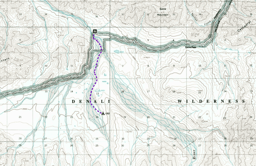
It rained off an on all night, but adjustments we had made in how we pitched the tent seemed to have paid off, and we awoke to no more puddles inside the tent. Not that it much mattered—this was the last day of the trip. So long as we ourselves were warm and dry, anything else could be dealt with later.
We had planned to camp significantly farther into the valley to our south; the fact that we didn’t meant that our walk to the East Fork bridge would be that much shorter than expected. Even so, we were still in the Denali backcountry, where the freedom to move wherever you wanted to was paid for with constant, deliberate attention to where you were going and how you were getting there—and where all applications to the Dry Foot Club were immediately rejected.
The sun had burned off a good deal of the previous day’s cloud cover by the time we broke camp, and the morning air was sunny and clear. The last day was already shaping up to be a beauty, and we had the night’s lower temperatures working in our favor to keep the river relatively low. But a day and a half of rain had swelled the East Fork’s many braids since we’d set out only a few days before, and the crossings we had to navigate on the way back were the deepest of the whole trip. Swiftly moving knee-deep water can be extremely dangerous—especially when it’s bone-freezing cold, and double especially when it’s completely opaque, since you can’t see where you’re placing your feet—but it can also be crossed safely if you’re patient enough to find the right place in the river, and you make each step carefully, thoughtfully, and deliberately.
A few touchy stream crossings, though, and we were all but done—wandering the wide gravel flats below the park road with the day hikers who’d come in on the morning’s first bus. We talked jovially about the last few days as we jumped over the smaller braids of the East Fork that trickled their way across the river’s flat western bank, soaking up the sunshine as the clouds melted away. Before we knew it, we were splooshing our soaking trail shoes up the steps leading from the riverbed to the road. There were port-a-johns on one end of the bridge, with bear-proof trash cans and a large a-frame hut we assumed was used by the crew working to repair the road. Across the span was the bus stop, with a trailer for the bus dispatcher who would arrange our ride back to the depot at the front of the park. We were back in civilization—or something sorta kinda a little bit like it.
We’d still have to take the bus two hours back to the visitor’s center, where we would eat overpriced/underwhelming hamburgers and yardsale all of our rained-on gear in the burning afternoon sun across from the train depot while all the other park goers stop to gawk. Dirty, disheveled, and still wearing the same clothes we had on when we first arrived in Denali, we would enjoy an upgrade on our train tickets, courtesy of nothing but the kindness our friends, and ride to Fairbanks as the grossest people in Gold Star Class. Once in Fairbanks, my aunt and uncle and cousins would make sure that we were never for a moment hungry or bored, cramming an impressive amount of activities and food into our brief stay before taking us to the airport, where we would, at last, leave the last frontier behind.
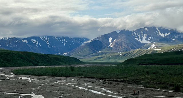
But before all of that, we had a moment, while waiting for the next bus—once we had repacked our packs, tying down anything that might come loose and burying our borrowed cans of bear spray safely inside their nether reaches—when we could stand on the bridge of the Toklat River’s East Fork and gaze out across the landscape through which we’d wandered. A few tenacious clouds were still breaking apart the sunshine, letting shafts of light play across the ridges and the peaks, the long streaming gravel bars and the rolling green tundra. We didn’t say much, but watched the scenery, lost in our thoughts about what we’d done and seen over the last few days. I thought back to a lunch I’d had with a friend in Christchurch, New Zealand, a couple of days after we’d both left Antarctica at the end of a long, cold working season. He had spent a couple of summers in Denali, and had been visibly excited when he’d heard that Sean Meadow and I were planning this trip. “It’s a special place,” he’d said. His eyes had a far-away look, but there was a small smile playing at the corners of his mouth.
“It stays with you,” he’d said.
And so it does.
- Denali, which comes from the Athabaskan word meaning The High One, is the highest peak in North America and a true giant—even among its siblings in the Alaska range. Towering at 20,310’ (6,190m) above sea level, its base is broad and wide, dwarfing its neighbors (which would otherwise be imposing on their own), and giving the mountain a tendency to appear much, much closer than it actually is—in those rare moments when it can actually be seen through the screen of clouds its bulk creates. ↩︎
- Incidentally, I am not going to resume using the outdated imperialist name for the highest peak on the continent just because some dumb racist idiot decreed that it should be so. Today’s Alaskans continue to use the name given to it by the region’s first long-time inhabitants, and that alone should be good enough for anyone else. The mountain’s fucking name is Denali. ↩︎
- It’s easy for Antarcticans to become snobs about the whole “midnight sun” thing, because during the Antarctic summer the sun truly never sets. From October to February it’s basically nine in the morning, twenty-four hours a day. In subarctic Alaska, the sun does set—but only for a little while, and then only barely. In other words, sunset or no, nighttime in the Denali summer is bright as shit, meaning that as long as I was in a thin cuben-fiber tent, I would need something covering my eyes if I actually wanted to sleep. ↩︎
- I was going to detail for you what I had, but I think you’ll enjoy enjoy yourself more if you just picture us eating something you yourself would like. Trust me, whatever you’re currently picturing is probably better. ↩︎
- It was. ↩︎
- Sean Meadow, in fact, had an elaborate system I didn’t at all understand, including an inflatable pad, a half-size foam pad, an inflatable pillow she did not use as a pillow, and a buff stuffed with clothes which she did use as a pillow. ↩︎