Day 46: 01 June, 9.7 miles today, 693.2 miles total, Weminuche Wilderness, CO
Sean Meadow got the last ice axe in Pagosa Springs. The kind souls at the Ski and Bow Rack seemed genuinely distraught when they informed me that they had just recently sold out, then took it upon themselves to start calling every other outfitter in town before tracking one down. When we got to the other outfitter, we shared a tense moment when we finally did the math and came to the obvious realization that there were twice as many of us as there were ice axes. In the end, Sean Meadow bought it. She swore she would share it, but that’s not how gear like that works—besides at 50cm, it was technically too small even for her, let alone me. Better that one of us have one. I would just have to keep making do with trekking poles: at least I wouldn’t have to carry it.
We’d met a trail angel at 2 Chicks and a Hippie, when he came over to our table and introduced himself while we stuffing our faces having just gotten into town. He’d given us his number and asked us to call him when we needed a ride back to the trail. Just like that, we were set. By 0800hrs we were pulling away from the hotel that had nurtured and protected us for three nights; by 0830hrs, we were back at Wolf Creek Pass. We pulled up just in time for two hikers who had just finished the last section to get a ride with our driver back into town.
The first few miles were steep, but largely uneventful. Only a handful of blowdowns slowed our ascent, and we passed only the occasional small patch of lingering snow. Then we entered a forest with several feet of snow on the ground, and the hiking got a lot more difficult. Even when we came out of the woods, the fields of snow continued on, so we slogged over the mushy white mess. When we came to a steep descent, Sean Meadow pointed out a section where someone else had clearly recently slid down on their butt. “You can use the ice axe if you want to glissade,” she said. “No thanks,” I replied, “I don’t like glissading anymore.” She didn’t say anything, but made the sort of sad sound people make when puppies slip on the stairs.
We stopped for lunch at a small patch of dry earth, where we luxuriated in the sunshine until the wind picked up and drove us onward. We didn’t have much snow to speak of, but we did hit a traverse across a snow-covered slope. The drop wasn’t terribly steep or terribly far, but it certainly wasn’t flat. I was about halfway across, well behind the rest of the group, when I fell.
I was moving slowly, testing each footstep before putting my weight on it, but even so, the snow beneath my downhill foot suddenly gave way, taking the snow under my uphill foot with it. I began sliding down, picking up speed alarmingly fast. I dropped my uphill poll and jammed my downhill pole into the snow in an attempt to arrest my descent, but at first it didn’t do anything. I put all my strength into the burying the tip in the snow, my shoulders burning with the effort, and I came to a stop. The whole thing had happened in fewer than five seconds. I had slid all of 20 feet.
The most difficult part of getting back up to the trail was simply trying to properly orient myself. I was more or less on my left side, and it was a struggle to rotate my pack, heavy with seven days’ worth of food, so that I was flat against the mountain. Once I’d managed that, it was mostly a question of walking back up. I was unhurt, and even if I’d slid all the way to the bottom of the slope it was unlikely I’d have suffered anything worse than superficial bruises and scratches. But it was scary—one moment my feet had been securely planted on the snow-covered path, the next I was rapidly accelerating down the side of a mountain. I was pondering what this might auger for the more treacherous crossings that lay ahead when, some thirty seconds later, it happened again.
If the first fall had been unnerving, the second landed somewhere in the shallow end of the traumatic spectrum. I stopped myself, as before; righted myself, as before; and returned myself to the trail, as before—but now I was shaken. I didn’t want to keep walking along the traverse, but of course I didn’t have much a choice. It was with extreme gratitude that I reached the far side and returned to solid ground. Thankfully I wouldn’t have to cross another snow field for the rest of the day. I would have lost my god damned mind.
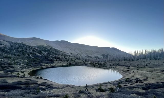
We called it early, since it was our first day out of town and we had the opportunity to set up camp by a pretty alpine lake and simply enjoy the evening. We had a long, potentially dangerous stretch ahead of us. This first little bit hadn’t gone smoothly for me, but as I drifted in and out of the dinnertime conversation, strumming the uke when the urge struck me, I let myself hope that the next 80 miles wouldn’t be so bad.
Day 47: 02 June, 17.1 miles today, 710.3 miles total, Weminuche Wilderness, CO
I spent the first few miles of the day suspiciously scanning whatever turns I thought might lie ahead in the trail for signs of snow, but we actually saw very little all day. What we did see was the reason friends who had hiked this trail in previous years insisted so strenuously on taking this route. It was a hard day of hiking, to be sure, but it was also one of the most beautiful days of the CDT so far.
The high point of the day was South River Peak, the 13,100’ summit of which we passed beneath on a saddle after a long, grueling climb up into the sky. It was the sort of trail that feels dangerous but isn’t—especially when you look ahead and see people above you seemingly walking on air next to the rock face. In truth, you’ve got plenty of good, level tread, but it really feels like you’re suspended above the trail, and the fact that you can’t see the mechanism holding you in place is just a little bit gut-wrenching. It’s a cheap thrill with a killer view, and we crossed it less than five miles beyond the turn-off for the lower-elevation shortcut to central Colorado. The Red Line was already rewarding our questionable decision making—though as we discussed over lunch, if that climb had been as snowed in as much of the previous section had been, the only question would have been whether most of us would have shit ourselves before passing out, or afterward.
We crossed the occasional patch of snow, but nothing too particularly sketchy until near the end of the day. The trail skirted a tight, curved chute, with a lingering blob of snow sitting right in the middle. The chute was steep, and while mostly clear of snow, it was covered in small, loose rock, almost like gravel. If you slipped there, nothing would stop your slide for a good 100’ to a waiting pile of jagged rocks. As I walked up, PA was testing the first few steps across the snow, but he quickly and gingerly gave up trying to cross that way. “I lost my nerve,” he confessed as I drew near, “that snow is super, super soft.” “That seems reasonable to me,” I said, “that’s a hell of a slide.” We looked at the problem for a minute, and eventually figured out that there was a safer—though no less sphincter-tightening—way across, above the snow patch. The earth there was soft and loose, but was much more stable than the snow. PA started across, with me about 20’ behind. At one point, a rock I’d disturbed, about the size of an apple, went rolling down the chute, past the trail, all the way to the bottom. “That could be me, next,” PA said. “You need to stop talking now,” I replied.
Safe on the far side of the snow patch, we waited for the rest of the group to show them the route we’d taken across. While we waited, I had to face uphill: facing out, the view of drop just beyond my feet had been making me dizzy. In the end, we all crossed without incident, and everybody made it to camp in one piece. It’s hard to ask for a better end of a day than that.
Day 48: 03 June, 15.0 miles today, 725.3 miles total, Weminuche Wilderness, CO
Today was everything hard.
Thru-hikers breeze though a place; we simply don’t have the time to set up for a while and take a location in. We get one brief impression, and that is how we will always think about afterwards. For example, despite all the rhapsodic words written by John Muir (and others) about Yosemite, despite the images captured by Ansel Adams (and others), despite the fact that I know I ought to a more considered opinion about the place, my one memory of my time there as I walk through on the PCT is: mosquitoes.
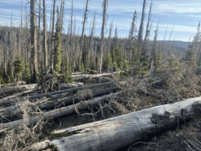
K. had been very concerned about a week-old comment in the guide, that read “Next 4 miles are hell. So much snow. Exhausting,” referring to what would be the first bit of hiking we’d hit after leaving camp. That had been that hiker’s snapshot impression of that stretch of trail. But such impressions are not intrinsic to the place about which they are made; my own impression of the first two of those miles was that they were a rat’s nest of blow downs (as was common any time the trail dipped below tree line). That’s not a permanent feature of the CDT. 15 years ago, before the pine beetle epidemic, most of those trees were alive and thriving. In a hundred years they will have rotted away to pulp—or they could be cleared in a month by an industrious team of trail workers. Snow, obviously, is still more transitory of a landscape feature.
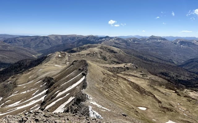
Once past the blowdowns, the morning’s walk took on a more leisurely feel. It was easy to see why the presence of snow would cause someone to describe the area as hellish—a series of steep climbs lead to a long walk along a series of ridges, comfortably rounded at the top but with big drops to either side. Walking on a dirt path it was a scenic extravaganza, an easy hike with a million-dollar view. If it’d still been completely capped in snow, however, it would have been terrifying.
We didn’t see snow until later in the morning—but once it made an appearance it just kept coming back. We were climbing up a valley wall and came to a few snow chutes that weren’t terribly long, but had some high-consequence drops. We stopped to put on our spikes, then started across. PA, Unknown, and I were still had halfway to go when Sean Meadow and Shorty, both safe on the other side, started talking loudly about a spot where a previous hiker had obviously slipped part of the way down. “Can you not talk about that while we’re up here?” Unknown said, and we finished the traverse in silence.
We managed to avoid most of the other chutes in that section by hiking beneath them and then climbing back up to the trail, but that process was exhausting. So I was all but worn out by the time we got to the Knife’s Edge.
A knife’s edge, strictly speaking, is when a trail traverses a ridge with a sheer drop on either side—the ridge walk we’d done earlier in the morning could have been considered a very blunt knife’s edge. The Knife’s Edge before us was not that, but a thin trail along a sheer wall, a hundred feet or more below the top of the ridge. It was more of a “knife’s side” than edge. Regardless, it would have been a real clencher of a walk on any occasion, but the dozen chutes packed with the same soft, slippery snow we’d encountered on the walk up made taking the Red Line route across out the question. We had to find another way across.
You can think of the Knife’s Edge as a line across the interior of a bowl; what we had to do, then, was find a way down into the bowl and back up the other side. This was not a gentle or easy option—it was just the less suicidal alternative. In fact, once we got going we got a sense for just how difficult our chosen route was. Instead of slick snow, we had sand and loose gravel, unstable rocks, and, well, snow, but at slightly less severe and angle. It was treacherous terrain, and it was slow going getting down it. I kept my the hood of shirt up so I could ignore the drop we were painstakingly navigating. It was only when we reached a lake at the bottom of the bowl that I looked back at what we’d just done. I couldn’t figure out for the life of me how we’d done it.
They way back out was worse. In theory, a trail lead from one of the lakes in the bowl back up to the rim, but we kept losing it in thickets of a hardy, sharp-branched scrub brush Unknown identified as “pussy willow,” but I referred to as “shit fuck willow.” The branches were excruciating as they scraped into my sunburned legs, over and over and over. My feet would tangle in the low branches and I’d lose my balance, but still be held upright by the snarl of branches at chest level. At one point we came to a small cliff, and I had to throw my pole somewhere up ahead so I could pull myself up by the branches of some overhanging shrubs. It was agonizing, and it seemed like it would never end, until it finally did.
It took four hours to hike the remaining five miles of the day. Each of was spent, and we paused to rest at every trail junction and at the top and bottom of every climb or descent. The tread was all mud, snow, water, brush, rocks, and blown-down trees. We hiked all of 15 miles, but felt like we’d just done 50. We were in some of the most beautiful countryside, grand, sweeping vistas that belonged only to us. We were lucky to be there to see it, to be among the few—even among CDT hikers, many if not most of whom had bypassed this entire section by taking the lower-elevation Creede Cutoff route—who had sat beside their packs and just stared in quiet contemplation at the heart of the San Juan range…but none of us gave a shit. All we wanted was a hot meal and a warm bed. It would be our once we finally made it to camp. We just had to walk there, first.
Day 49: 04 June, 18.2 miles today, 743.5 miles total, Weminuche Wildeness, CO
Some days just work.
I don’t know that I have to report on today beyond that. We hiked far (for the San Juans) on good trail over several large mountains. We got a glimpse of the Rio Grande Pyramid at mid-morning break, then lost sight of it for a while as we hiked down into a field of overgrown shit fuck willows (I’d learned my lesson, however, and had kept my leggings on all day long for just this eventuality). At lunchtime, we sat across an open field from it, and afterward headed up, passing in between two massive, towering ridges as we climbed. It gave the hike the feeling of climbing an actual pyramid, of entering someplace sacred, magical, and divine—which I am sure in a very literal sense we were. There is a reason mountains across cultures have been considered homes to the gods or, frequently, gods themselves. They demand respect, if a sort that even the most irreverent mortal can’t help but feel something ancient and vast stir within himself when in the heart of a temple such as this.
We had good weather, almost no snow, good tread, manageable blowdowns, and just absolutely breathtaking views all day long. We’d really started to notice how alone we were on this section of trail; with few exceptions it felt like we had the whole San Juan range to ourselves. We worked for it today, as always, but this was a good one. Today really paid off.
Day 50: 05 June, 15.2 miles today (+3.8 miles on CT en route to Silverton, not added to total), 758.7 miles total, somewhere along the Colorado Trail, CO
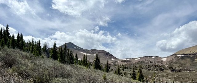
I think we found the beating, majestic heart of Colorado today. I had secretly been hoping that this state would prove to be overrated, because then it would be easy for me to be arrogant and dismissive of the things that have made this trail especially challenging, but alas. It really did prove to be that beautiful, and each day was more gob-smackingly gorgeous than the last.
It was common for Shorty to get a later start out of camp than the rest of us, but he always caught up by the time we stopped for water or for a quick mid-morning breather. Today, however, he was absent at every stop—and we started making a point of waiting at the top of every climb for a few extra minutes in case he showed up. We were becoming increasingly concerned, because today was the day we would hit the Colorado Trail, which we would take to get into Silverton to resupply. Nobody was entirely sure whether he knew which junction was the right one.
Our concern was a bit overdone. Yes, Shorty was significantly younger than most of us, and yes, he did seem to act like a happy-go-lucky kid sometimes; but he was also a grown adult who was fully capable of navigating a trail system. The day’s hiking was strenuous, but not sketchy, complicated, or technical. He’d gotten a late start, but was still on track to catch us—a fact that we realized not too long after we’d left the CDT and started down the CT. We hit the bottom of a massive series of switchbacks and looked up to see him making his way along those at the top. He was fine.
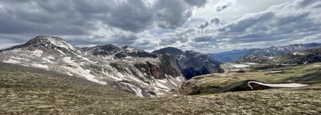
The CT wasn’t at all what I expected. The mountains bordering the trail were close, massive, steep, snow-laden, magisterial. The trail hugged one side of a very steep valley, and as we lost thousands of feet of elevation, all of our thighs began to burn with the effort. We’d hoped to camp maybe 2 miles in, but there were no flat spaces of any kind almost all the way to the valley floor. Once we finally got there, we found every potential campsite decimated by old avalanches, the defeated carcasses of trees piled on top of every surface. It was a surreal landscape, one inhospitable to our needs, so we had no choice but to keep walking, even as each fatigued step collided with a fallen branch or a stone or some other agony. By the time we stopped I was completely done in, a human-shaped vessel of pain and exhaustion. The good news was that the next day would be short; the bad news was that it was start extra early.
Day 51: 06 June, 0.0 miles today (+6.0 miles on CT en route to Silverton, not added to total), 758.7 miles total, Silverton, CO
I didn’t feel great in the morning, which was confusing. We’d dropped 3,000’ in elevation on the CT, and I expected both to sleep like a stone and to wake up feeling like a superhero. Instead, I felt lethargic and had a mild but persistent headache. It was nice, at least, to be able to dig my morning cat hole using my good old lightweight aluminum trowel—for days I’d relied on borrowing Sean Meadow’s ice axe to break open the frozen alpine tundra to which we’d awoken every morning above 12,000’.
I was not at my hiking best, tripping over every root, kicking rocks with one foot into the other, stumbling over sticks, and stubbing my right-foot big toe on everything nature had to offer. We were hiking on a deadline, trying to make it to a railroad crossing before the trail was scheduled to pass, and I was struggling to keep up. Not trusting myself not to fall off the dead tree everyone else used as a bridge across a section of trail that had apparently fallen into the river, I waded across the freezing snow melt and spent the rest of the hike sloshing in my wet shoes. We’d agreed to leave early to catch the train, but when I learned that we had a mile left to walk and three hours in which to do it, i slowed my pace considerably. Thru-hiking is frequently an exercise in working through the pain, whatever it is. You have to be tough to make miles—not tough like the insecure macho guy at the bar, but you have to let the part of you that cares about foot pain and cuts and scrapes and achy shoulders sort of callous over. But with three hours to hike one mile, for once I didn’t have to be tough. I could just walk like my feet hurt and I was tired and I had a headache. I still made the train crossing with plenty of time to spare.
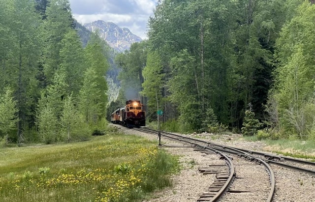
We were giddy when it came. At first, the echoing of the engine made the sound of the train hard to identify. The timing was right, but it could be a helicopter like the one we’d spotted earlier flying low through the valley. Then we heard the whistle and cheered. Our ride into Silverton was on its way. As the train came into view, we started signaling our wish to board in the manner detailed on the website for the Durango Silverton Railroad: “the correct method [for flagging the train] is by waving your hands horizontally across your knees.” [emphasis in original] So we stood next to the tracks and did the Charleston.
The train slowed to a stop and a pair of conductors jumped out. First they stowed our packs in an old fashioned boxcar, then they lead us to the open-air passenger car adjacent to the dining car. I got an IPA before I even paid my fare. For the next half hour, we smiled and pointed like excited children. The scenery was beautiful, the beer was cold, the train ride was a wonderful novelty, and best of all, we didn’t have to walk.
Silverton is a little fairytale gold-rush town, a village of 600 whose main industry are the tourists who come by train and recreational vehicle, made up of old west style storefronts and bounded on all sides by giant mountains. It looks like the main street in South Park brought to life. It’s a pricey spot—an unfortunate detail for those of us in town specifically to buy our resupply at the appallingly overpriced grocery store—but it is damned pretty. We were only going to be in town long enough to get our chores done, and then we’d be headed right back to the trail. How we’d get there was still an open question, as every attempt to secure a ride had fallen through. But we’d have to cross that bridge when we came to it; in the meantime we had burgers and ice cream to eat, hot showers in which to luxuriate, and soft beds in which to sleep. The trail would keep.