Day 27: 13 May, 17.3 miles today, 439.5 miles total, Mt. Taylor, NM
The low point in the day might actually have been the moment we put on our packs in the hotel room. We’d given ourselves the gift of sleeping in until 0700, but the 10lbs of food and 10lbs of water we were each carrying felt overwhelmingly heavy strapped onto bodies that had barely spent any time in an upright position during the last couple of days, let along bearing weight.
Still, our blissful period of rest was over, and before long walking with a bully backpack felt relatively normal once again. As we walked along the road out of Grants, passing not one but two prison complexes run by the state of New Mexico (including at least one faded road sign advising motorists not to pick up hitch hikers in the area) the sense of a familiar routine settled into my stride. For better or for worse, this is what we did now. We’d adapted to hiking.
Not that that made road walking anymore enjoyable. Today, at least, our rigorously tested patience was rewarded with an actual trail. Leading up away from the road and along a semi-wooded ridge, the Mt. Taylor trail was the first actual trail we’d walked on in lord knows how long (we’d been off the road for the stretch that had connected the Cebolla and Bonita-Zuni alternates, but as we were simply following cairns for miles through a lava field, I don’t think that counts). We had a bit of a climb to reach the ridge, but the surface was so comparatively comfortable we each barely noticed.
We made a relatively early day of it, calling it quits when we ran into some friends of ours who had set up camp below the tree line. In the morning, we would get up early and summit Mt. Taylor in the morning chill. In the meantime, we’d sit in a lopsided circle, eating our first dinners back on trail and laughing, as idly picked my guitar. The weather was good, the company was good, the general mood in camp was good. Appreciate those moments when you find them, because god knows what the next day will bring.
Day 28: 14 May, 22.4 miles today, 461.9 miles total, big nowhere, NM
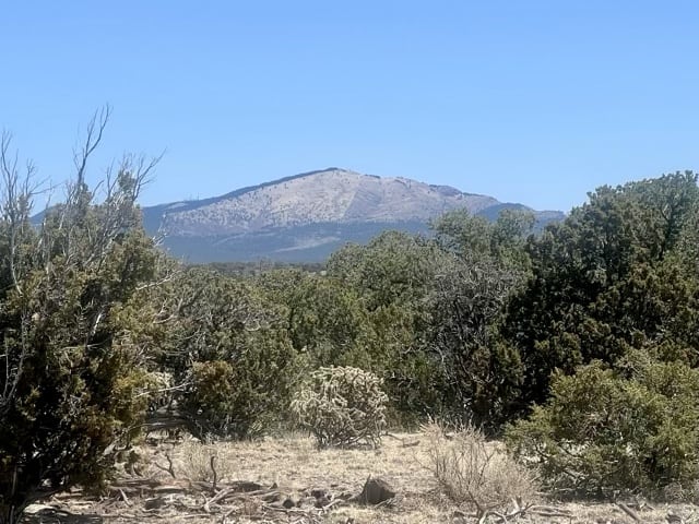
The climb to the top of Mt. Taylor was a steep kick in the pants, but it felt good to be on an actual trail, going up an actual mountain—almost like we were actually hiking, or something. We made it up a couple of hours after sunrise, so even though it was still chilly at 11,300’ (and still a few patches of snow in the shade, in fact), we nonetheless had the sun to keep us warm. The view from the peak was appropriately spectacular, and Sean Meadow and I ate the “summit snickers” she had thoughtfully muled up the mountainside for us while taking in half the state of New Mexico.
We spent much of the rest of the morning hiking up and down the rim of that dead volcano’s caldera, which was very scenic but also very slow going. When we stopped for lunch we’d barely gone 10 miles, but by then the terrain was flattening out and we were close to getting back onto the CDT Red Line. Distinctly less scenic than the Mt. Taylor alternate had been, the CDT also became increasingly open as we hiked onto it and headed north. The thinning of the tree cover was gradual, though, and I wasn’t fully aware of how exposed I had become until I thoughtlessly brushed one of my calves and noticed that I had painfully sunburned my legs.
I stopped to apply sunscreen in an effort to prevent the problem from getting any worse, though by that point any contact with my legs was deeply unpleasant. We stopped for water late in the afternoon at a cow trough that was reported to be the only decent water source for miles. It was a disappointment, then, to find it thick with what we determined were most likely mosquito larvae. Whether it was those pesky little buggers or left-over cow drool I can’t say, but that water quickly clogged our filters so badly we had to backflush them several times before we were done. All told, it took us almost an hour to collect and filter 4 liters of water, which then we had to carry out. But at least we wouldn’t have to worry about finding more until midday, and we could get in a few more miles before dusk, the promise of fresh instant mash potatoes calling us onward into the evening.
Day 29: 15 May, 24.1 miles today, 486.0 miles total, Empedrado Wilderness Study Area, NM
The coyotes were so loud they woke me up. I’ve spent many nights sleeping outside in my adult life, and I’ve heard multi-layered cacophony of a pack of coyotes break the silence of midnight many times before, but always from a considerable distance. Last night, instead of the haunting sound of baying canids drifting across the hills, these sounded like they were no more than 50 feet outside our tent. I lay awake in my sleeping bag, thrilling to the sound and thinking idly about the fuss people make about an animal that, dangerous as it may be to chickens, poses no threat to an adult human. For me, it was one of the coolest moments of the hike so far. Sean Meadow slept through the whole thing.
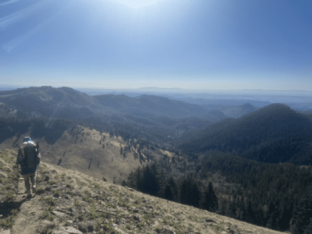
The day that followed was largely unremarkable. We carried water for ridiculous distances, fighting off the layers of dust that continually accumulated on everything, penetrating every protective layer put in place to discourage it. For several miles, we hiked without shade, as the midday sun beat against us like an angry, hot hammer. Then we came to a sudden drop, going down some 1,600’ and came to learn that for the last several days we’d been hiking across a plateau.
I stood on the edge for some time, when I came to it, staring at the astounding variety of scenery before me. Long mesas with intricate cliff faces ran for miles across an open valley from ancient mountains eroded into baroque figures on the desert floor. Mountains ringed the northern horizon, some painted in reds and pinks in the distance. It was the prettiest sight we’d seen in New Mexico since leaving the Gila’s middle fork weeks before. It was a masterpiece of painted landscape the memory of which I will always treasure—as my phone case was far too covered in dust to take a decent picture of it.
Oh well. You gotta live in the moment, anyway. That’s also how we happened to fall just 0.9 miles short of our goal for the day, even with a couple of hours remaining until sunset. After hiking for a couple of miles across the valley floor, we came to a flat, open spot too pretty to pass up. We were surrounded by breathtaking beauty in every direction—and in the distance, we could just make out the massive plumes of smoke from wildfires to the northeast. After nearly 500 miles of effort and pain, of tedium and flat, brutally hot fields of sand and spines and stones, we had finally found the land of enchantment, just in time to watch the whole thing go up in flames.
Day 30, 16 May, 27.8 miles today, 513.8 miles total, Jones Canyon ACEC, NM
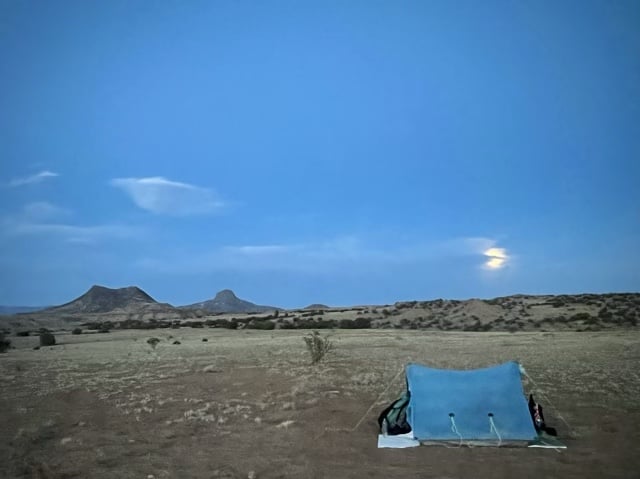
The evening had been warm, so we’d left the two vestibules of the tent rolled up for superior ventilation. That left us comfortably exposed to the night air, until the wind suddenly picked up around midnight, blowing dust into the tent and making the whole structure shake and flap in the breeze, making a terrific racket. Sean Meadow, on the windward side, got her vestibule closed first, though I wasn’t far behind. The noise of the wind abusing the tent was still unpleasantly loud, but better, and on the whole the tent felt more secure. As I lay in my sleeping bag, trying to get back to sleep, small eddies in the flow of the wind around the closed tent kicked up streams of dust from my vestibule which passed easily through the mesh of the screen door and coated my face. I had liked the coyote visitation much better.
Today’s hiking was absolutely gorgeous, but a genuine kick in the butt. We spent the day hiking first to one distant water source, and then a second, climbing up a long, long series of mesas, where we’d walk along the top for a mile or two before climbing down and up onto the next one. As a goal for the day, the second water source was a reasonable enough choice: we’d have to carry less water than I’d we chose to dry camp, and making it that far would leave us with only 15 miles to walk into town in the morning. But it wasn’t an easy day. When I came stumbling into camp just after sunset, it was clear that the other hikers by the water source were just as neat as I was.
It had been rewarding, though, and not just because we finally had some truly stellar scenery to enjoy; this was the day that Sean Meadow and I passed the 500 mile mark—one day short of our one-month trail anniversary. We paused at the point on the CDT Sean Meadow had calculated for a small celebration to mark the occasion. In a tribute to our real-life New Mexican experience, she constructed a large “500” next to the trail out of rocks and cow shit, while I tuned the guitar I had carried every step of that distance. We took a moment to reflect on what we’d so far accomplished, and encouraged the guys we’d been hiking with on this stretch to get their pictures taken with the monument, as they’d be coming up on their 500 soon as well.
We were hiking into uncertainty, the trail rumors of closures ahead rampant but unconfirmed. When we got to town we’d see what we could find about the fires we’d seen burning to the east as we hiked north, and how likely they were to affect our itinerary. Until then, all we could do was eat a hasty dinner in the deepening dusk and sleep, and in the morning, walk.
Day 31: 17 May, 14.5 miles today, 528.3 miles total, Cuba, NM
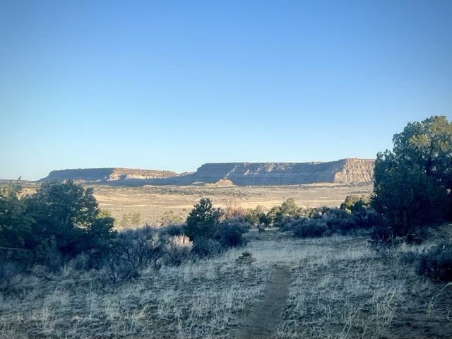
The trees thinned as we walked down the gentle northern slope just after dawn from our camp by the water source, opening up to a view of the Mesa Portales across the plain. It was a breathtaking tableau painted by the freshly risen sun, and I walked with a heart swollen with the joy that comes from walking unexpectedly into such stark, natural beauty—until I realized we would have to go over the damn thing.
It was a fairly brutal climb, but it was also fairly short, and before I knew it I was on top of the mesa, looking over the green-daubed valley, cut roughly by arroyos and stretching to the Jemez Mountains to the east. The traverse of the plateau’s edge was a scenic tour of majestic views and curious rock features that ended after a few miles in a broad, flat cow pasture. The walking surface alternates between soft, shifting sand and exposed hard pan, neither of which felt particularly pleasant as the late morning heat started to build. It was almost a relief to get to the highway and start trudging along the shoulder.
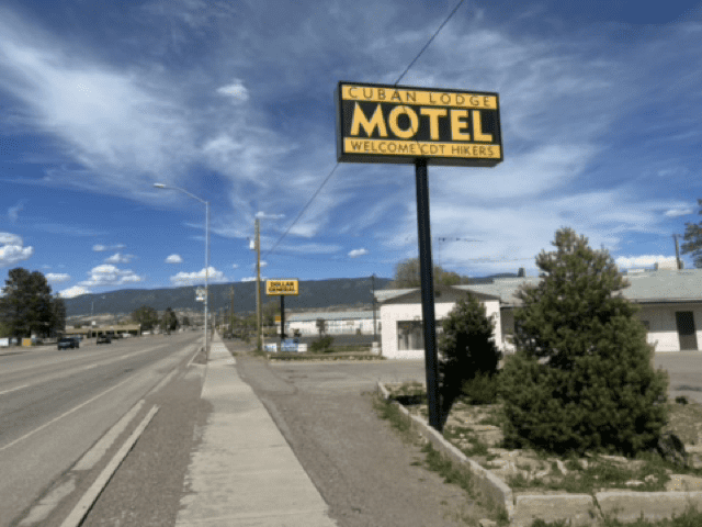
I could see the Cuban Lodge Motel (WELCOME CDT HIKERS) for a long time before I got there, as if it were somehow running away from me as I walked its way. When I finally arrived, I started looking for the proprietor, whose name and phone number were taped to the window of the locked motel office. I heard a voice calling as I was about to call the number. I turned around to see an older woman, leaning out of the open door of one of the rooms. “Are you Flora?” I asked, using the name written on the office window. “I don’t answer questions like that,” she replied.
The rest of the conversation didn’t go any smoother; much of it was spent trying to convince the lady that Sean Meadow was a woman despite having the first name Sean—and this despite the fact that she’d had a face to face conversation with Sean Meadow when she’d left her pack at the motel. I’d hoped to leave my own pack there as well, but after a great deal of confusion we couldn’t seem to resolve I just strapped it back on and walked to meet Sean Meadow and a group of other hikers at the McDonald’s across town.
I was a bit of mess when I walked through the door: hot, tired, irritated, and hungry. Before I could even set down my pack or the box I’d had to wait for in an interminably immobile line at the post office on the way over, the other hikers wanted to talk to me about the situation on trail. “Hang on. Let me order some food at least,” I said and went to go stand in line at the counter. I came back with my order placed, a massive, frosty cold diet coke in my hand, ready to hear what the group had figured out. It wasn’t good news. In a day a half the Forest Service would officially close the Santa Fe National Forest, effectively shuttering the CDT from Cuba to the Colorado border. We’d been hopeful that morning for better news—this was Sean Meadow’s and my one-month trail anniversary, something we’d hoped to celebrate with a relaxing evening in town.
But now we were stuck, left to scramble along with everyone else trying to figure out what we were going to do from here.
Day 32: 18 May, 0.0 miles today, 528.3 miles total, Cuba, NM
A permanent fire season—with its attendant trail closures and reroutes now a possibility at pretty much any point along a thru-hike—was becoming the new normal for the CDT. By 2022, America was basically always on fire somewhere, a fact which affected people hiking in the western US no less than anyone else in the more flammable parts of the country. “In the future it won’t be possible to do a continuous thru-hike of the CDT in the traditional sense,” I’d overheard a hiker at an adjacent table saying during a lull in our own routing conversation at McDonald’s the day before. “Actually,” he continued, “that might already be true.”
“A continuous thru-hike of the CDT in the traditional sense” was definitely off the table for us at this point. With the Santa Fe National Forest closing the following morning, we couldn’t hike any portion of the CDT from Cuba to the Colorado border without incurring the risk of walking either into a wildfire (unlikely) or into a $5,000 per person fine (more likely) if we were caught with the NF boundaries by the Forest Service at any point after 0800 on Thursday. Trying to sneak along the last 150ish trail miles of New Mexico simply wasn’t worth potentially burning alive or losing $5K—either of which would mean the immediate end of our hike.
The fire most responsible for our immediate woes was the Hermits Peak fire, which was located on the far side of the Santa Fe NF, but which had barely been contained thus far. It had started as a prescribed burn that had quickly grown beyond the prescribers’ ability to control it when “unexpected erratic winds in the late afternoon caused multiple spot fires that spread outside the project boundary.” It’s hard to imagine anyone who has been to New Mexico could ever not expect erratic winds, but whatever. By the time the Forest Service made the call to close the trail, the Hermits Peak fire had become the largest wildfire in the recorded history of the state.
Whatever the cause, the fire—and the resultant trail closure—meant that Sean Meadow and I would have to chose from a short list of undesirable options. We could skip north to Chama, NM, a trail town close to the Colorado border, and hope that we could find the time to make it back down here at some point when the area wasn’t on fire but also still within the year-long window we had to complete a “thru-hike.” A lot of hikers were taking this option, which meant that rides were already getting hard to come by; but it was in most senses the least complicated choice. There was just more uncertainty involved in that final step than either of us would have preferred.
We could also skip much farther north to the Wyoming basin and start hiking south. Though this option was logistically the most complex, it would get us clear of both the fire and the glut of thru-hikers trying to get away from it. We could hike the basin at a time of year when water wouldn’t be difficult to find—a true rarity for CDT hikers, pass through the Colorado highlands at roughly the same time we would have done going north, and then hopefully return to northern New Mexico at a time when the trail would have reopened. Unfortunately, that last step was a big, steaming if. There was no guarantee that the Santa Fe National Forest would have reopened deeper into its traditional fire season. Furthermore, hiking in the heat of the day was barely tolerable in May, and the idea of trying to walk this section in July was unpleasant even to consider. Beyond that, we have to find a way to get ourselves to Wyoming twice: first so we could hike south to Cuba, and then back again so we could continue north to Canada.
The option we chose was possibly the least enjoyable, but had the virtue of being the simplest. We would continue our NOBO footpath by road walking 80-something miles along a pieced-together string of state highways from Cuba to Chama. We wouldn’t be on (or even near) the CDT, but in the spirit of this trail we were thinking of it as just another alternate—and one in keeping with the official trail’s unfortunate fetish for making us walk on roads whenever possible. The two major obstacles to this course would be the paucity of information we would have as to any possible sources of water, and (as we’d learned on our cross-country bike trip) the difficulty of finding a safe place to pitch a tent by the side of the road.
Those were the problems we set about solving on this unexpected zero (and which, to be honest, were solved much more by Sean Meadow than by me). Road walking sucked, and we were about to take on a truly miserable amount of it, frequently with an ungodly amount of water on our backs. It was a terrible choice, but seemed from our beat-up room at the Cuban Lodge Motel (WELCOME CDT HIKERS) to be the least worst of the crappy options we had. We were heading off the beaten path, hoping that by the time we’d be back on it once again things would be more or less back to normal—by trail standards.
Keep them coming! Love reading the intricate highlights and feeling a bit like a fly inside your tent!