Day 20: 06 May, 3.0 miles today, 338.0 miles total, Pie Town, NM
Breakfast at the Top of the World general store was not worth the wait. Perhaps in prior years it had been a good stop for CDT hikers—it even have been so just a few weeks before we got there. But by the time we arrived, the place had been thoroughly picked-over, and we were faced with more empty shelves than merchandise. I’d been hoping for a microwave breakfast biscuit at the least, but even those were long gone (though the empty box from which they’d been sold was left in the freezer). So Sean Meadow and I ate a family-sized bag of Fritos each and split a cold can of bean dip. Then we walked the three miles to Pie Town.
Our original plan had been to camp at the RV park in town and skip the madness of the Toaster House, Pie Town’s free* hiker hostel, but that was when we believed that we’d be able to do laundry there. We’d been misinformed by the clerk at the TotW, which turned out to be the only public laundry for thirty miles in any direction, and we’d passed it up. It would sink laundry for us now, no matter where we stayed. So it was that the lure of a warm bed inside a building was too tempting an opportunity to pass up—especially for Sean Meadow, who had been freezing every night despite wearing every article of clothing she had inside her 15° sleeping bag—and since we’d arrived early in the day we’d have our pick among those in “the penthouse” upstairs.
The Toaster House was what the more low-budget hostels along the AT would be like if nobody was actually in charge of them. Chaotic, perpetually untidy (though not particularly filthy, overall), but comfortable in a dirt-baggy kind of way, the place was vaguely overseen by an odd couple of individuals who had nothing in common but the house, and whose connection to the house was difficult to discern. There was the 60-something man who lived there, who seemed to prefer to keep his involvement in the house limited to playing keyboards with the hikers, and whose reputation for creepy behavior toward single women had reached us weeks earlier in Lordsburg. And then there was the woman we refereed to among ourselves as the “Toaster House Mom” who seemed earnest in her desire to create a space dedicated to helping the CDT community, but who also expressed that desire most of the time by yelling at hikers.
There was also an older, matronly woman who gave rides to the nearby town, but I only met her the following morning as we were leaving and she was making rounds on the porch, hugging each hiker goodbye. She may have been the homeowner, though even that detail was vague to me.
Sean Meadow and I met the Toaster House Mom when we were upstairs in the penthouse talking about our experience at Top of the World, and she started yelling up from the kitchen that we hadn’t actually been there, or she’d have seen us. It was a strange argument to make, but she refused to back down until I pointed out that we had camped there the night before. When we came downstairs, she gave us a lecture on how this year’s substantial increase in the hiking population had put a severe strain on the house’s aging septic system, and so it would really be better if we used the port-a-potty out back. After hearing reports as to its condition (“fucking gross”), we opted to make the five minute walk to the RV park down the road anytime we needed to anything other than pee—which also saved us waiting in line as more and more hikers showed up throughout the day.
We learned shortly after arriving at the Toaster House that H (trail name pending) had been there the night before, but had left even before we’d gotten there. We also learned that she’d been bestowed the trail name Burner, for being the vey last hiker to make it through the Turkey fire on foot before the Forest Service started shuttling us past it.
We were chatting with several hikers we knew—it was surprising given how few people we’d seen each day while on trail—when who should walk through the door but our old friend Caterpillar. He’d “gotten off trail,” as the saying goes (meaning that he’d quit) and had come up to Pie Town to say goodbye to friends before heading home. It’s usually bittersweet when a friend quits the trail: except in those rare events when a hiker is forced off by sudden personal tragedy, the person leaving has usually been suffering for a while, and the decision to stop has been a long time coming. Caterpillar’s ankle had been hurting him terribly for weeks—and it had swelled to disturbing proportions by the time we saw him—and the increasingly cold nights as we all slowly pushed north had become too much for him. It was sad to see him go, but good to know he was doing what was best for himself (including waiting until he returned to the EU before seeking medical care for his ankle).
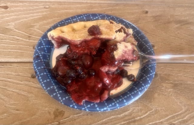
All that was left, then, was to cram all of our town chores in between pieces of pie from the local cafe and beers on the back porch of the Toaster House with our friends. We’d be back at it once again come morning, hopefully warm and rested and ready for a new stretch of trail.
*donations accepted
Day 21: 07 May, 15.8 miles today, 353.8 miles total, TLC Ranch, NM
We’d committed ourselves to having breakfast at the local diner before leaving town, knowing both that the hungry hiking population would completely overwhelm the restaurant’s tiny staff, and that they wouldn’t open until 0900. So we got to sleep in—or at least lay restfully in the warm bed while the conversations of the hikers in the kitchen gradually rose from whispers to full voices.
The staff of the diner was, as predicted, immediately overwhelmed, even with the Toaster House Mom putting in a shift as a volunteer waitress (she really did mean well, I think, even when she came off otherwise). But we weren’t in a hurry, and the breakfasts were all really good, when they eventually arrived. We ate our leisurely meal and didn’t get started on our day until well after 1100hrs, by which time the sun was high and hot in the sky.
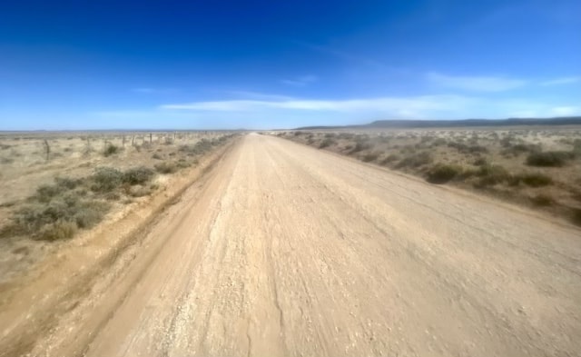
I left Pie Town with a new blister I’d picked up on my right foot, under a callous, on the road walk to Top of the World. The marvels of desert hiking are endless. We had a road walk the entire way to the TLC Ranch, an old homestead that allowed hikers to camp on their property and our destination for the day. The road had obviously once been paved, but was being slowly re-eaten by the desert, leaving us to hike alternately on pavement and on sand, two of the least comfortable surfaces to walk on.
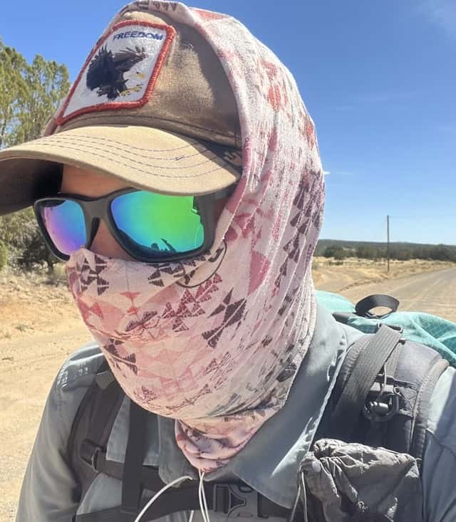
We were also exposed the entire way to the sun, as well as a wind that eventually grew strong enough to blow Sean Meadow’s sun-umbrella inside out. I managed to catch mine before disaster struck, but was still left to resort to what a friend of mine from the AT called “the Hollow Man look” to keep the sun off my face and neck. We were back in CDT boot camp, hiking North through a New Mexico devoid of comfort, views, or water.
The road had the desolated, remote look common to many of the backwoods dirt tracks we’d already walked so far, but whereas we’d typically only see one or two cars on those, if any, today we saw dozens—though where they were coming from was a mystery. Toward the end of the day, a man came up from behind me driving an enclosed golf cart with a camo paint job. He pulled up next to me, opened the door, and held up a silver pitcher. “Need any water?” he grinned at me. I’d left town with plenty, so I thanked him but told him I was doing well. He nodded and drove up the road to Sean Meadow, who was a few hundred feet ahead. I saw her accept his offer, then stand where she was talking to him. As I caught up to them, the man was going on about the weather: “if it’s clear tonight, should be a good night for star gazing, a good night to study the skies. We got a lot of UFO activity in this area, you know. I would know; I’m a UFOlogist. If you wanna see em, what you gotta do is find a fixed point of light in the sky, and if one next to it moves, that’s a UFO. But you ain’t gotta worry about gettin abducted. It happens all the time around here, but they’re particular about genetics. Only particular bloodlines, particular families get abducted. You’ll be fine.” Then he wished us a good hike and drove away, leaving us to trying and figure out what the hell had just happened.
Day 22: 08 May, 30.4 miles today, 384.2 miles total, South Narrows Picnic Area, Bumblefuck, NM
The TLC Ranch, like most other intersections of modest, rural civilization with the CDT, was showing signs of being overburdened by the (comparatively) massive increase in the number of hikers this year. The compound was still incredibly hospitable and its people kind: they’d set out three fresh 10-gallon jugs of clean water just as most of us were strolling up in the late afternoon. But there were also a great many hand-painted signs asking hikers to stay clear of the farmhouse (where they had once been welcomed, so I’d heard) and to keep to certain areas of the ranch. Not that doing so was difficult; besides which, they’d provided us not only with water, but a table to make dinner on and a composting outhouse down a short path. Not bothering the family just trying to live their lives at the TLC was an awfully small price to pay for such luxuriant amenities.
We hit the day’s road walking with a purpose that morning, the reasoning being that if we weren’t going to be walking anywhere interesting for a while, we may as well do so quickly. Such a purpose, though, is hard to maintain for long while doing something as tedious as walking in a straight line through an open field for a dozen miles, and I’d definitely been meandering for an hour (or two) by the time we came to the junction with the Cebolla Canyon alternate trail.
The canyon route was promising for three reasons: 1) it had two sources of water along its 25-mile length, 2) the section of the route that went through the canyon promised at least some shelter from the wind that had been steadily rising all morning, and 3) it would avoid *some* of the lava fields sprinkled along the main CDT route, which always sound interesting but end up being a nightmare to walk through. So we entered the canyon, and immediately started walked through sand.
We came to the first water source after a couple of hours, a muddy pond in a small basin. I filled my dirty bladder (i.e., the bladder I consistently used for unfiltered/untreated, or “dirty” water), and noticed almost as soon as I attached my filter that something was wrong. Water wasn’t passing through the filter, but rather cascading over it, as the internal gasket had apparently fallen out while I was cleaning it at the Toaster House without my noticing. Two thru-hikes with this brand of filter, and I’d never had this problem, though apparently it had become somewhat commonplace. What it meant, at any rate, was that I didn’t have a filter. I’d have to use Sean Meadow’s until we got to town and I could replace it.
We made good time after that, heading to our next water source, a cow trough we hoped to camp somewhere near, as that would put us at 25 miles from our start that morning—and would make this our longest day so far. We could see that that plan was not going to go as we’d hoped, however. After 10 miles walking merrily through the shelter of the canyon, we could see just how bad the wind had gotten over the course of the afternoon. From a couple of miles away, we could see that the cow trough—and the highway beyond it—was being blasted by a violent wind, carrying a steady stream of dust.
Sean Meadow got there a few minute before I did, long enough to attempt to filter a liter of cow water in the onslaught and decide it wasn’t worth the punishment she was taking—especially since we’d both need 20 miles worth of this water and we only had one working filter between the two of us. Her solution was to fill every container the both of us had with “dirty” water we could treat with purification drops after we’d found shelter. I quickly agreed, though just filling up the bladders proved to be tricky, as anytime I tried to pour water into one, the wind would spray it everywhere. Once that was finally done and everything was loaded, we stood for a while, awkwardly holding our packs and waiting for a break in a prolonged gust of wind that would allow us to put them on our backs without getting knocked off balance. The sand and dust peppered our skin as we tried to shield our eyes without dropping our gear. The roar of the wind was so loud, we had to shout at one another to be heard, even though we were less than five feet apart. “I FUCKING HATE THIS STATE.” “I KNOW. NEW MEXICO SUCKS.”
Our hopes for a campsite close to the water scattered to the winds like so much aerosolized dried cow shit, we hiked up to the highway, then followed it North. This road walk was part of the alternate, but it kept us in the middle of the wind for miles farther. There was nowhere to go to escape it; we just had to keep walking and hope that eventually we could find some patch of land that was protected from the wind and not fenced off. After five miles, we came to a little forested picnic area. There were signs prohibiting camping posted near the entrance, so we had to spend our rapidly fading daylight trying to find a flat spot we could throw our sleeping bags and not be seen by anyone who might happen to come by in the night. Eventually we did, making a haphazard camp on the far side of a couple hundred feet of tall grass. Only the occasional gust made it down to where we were hidden. Driven by the wind, we’d walked over 30 miles to get to this dusty, dirty sanctuary; just having that small patch of uneven ground was a massive relief. Grateful we didn’t have to shelter from the weather in the pit toilet, we ate a quick dinner, crawled into our sleeping bags, and soon fell asleep.
Day 23: 09 May, 22.0 miles today, 406.2 miles total, somewhere in NM
The wind had eased by the time we got up, but hadn’t quit the game entirely. Still, the force that blew over us as we started the day’s hike was gentler by an order of magnitude from the one that had lashed us for hours toward the end of the previous day. The rest of the walk along the shoulder of Hwy 117 was actually pretty pleasant, shaded from the sun by the giant sandstone cliffs carved into ornate pillars and archways by some mass of water long, long since extinct.
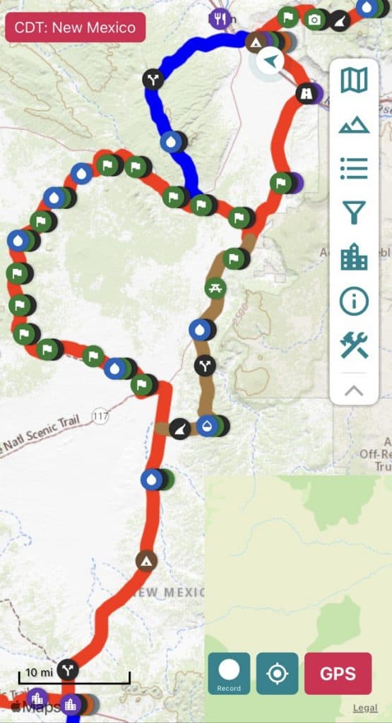
We reconnected with the main CDT route—called the “Red Line” by hikers because it was marked in red on the guide that all of us were using. The Cebolla alternate, by contrast was brown, and the path we planned to use to get to Grants, NM, the Bonita-Zuni alternate route, was colored dark blue. We were taking the Bonita-Zuni instead of the CDT because it was supposed to be prettier, even though it would add 10 miles on our way into town. But in order to connect to it from the northern end of the Cebolla alternate, we would first have to hike southbound on the Red Line for 6 miles.
I’d mentioned before that the Cebolla trail had avoided the lava fields through which that section of the CDT otherwise passes. Well, not only would we literally have to walk in the wrong direction to connect to the Bonita-Zuni, but we end up doing 5 miles of it through the longest stretch of ankle-twisting pumice in the area. Whoops.
It wasn’t all bad, in the sense that a challenge gives you something to focus on and overcome. Steep, awkward, and unexpected footing creates a sort of puzzle you need to use your body to solve—something climbers learn to do intuitively, but that takes time to get a feel for when hiking. I hadn’t had to negotiate anything like that yet on this hike—and if I’d known what we’d face down this route, I’d have lobbied to go the other way. I’d been feeling slow and beaten by the end of every day, more or less waiting and hoping that the sort of thru-hiker spryness I’d experience before in my life would find me out here, eventually.
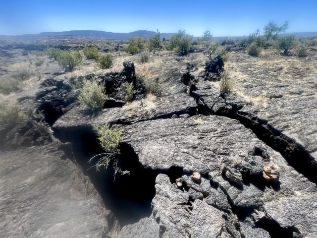
The fields we were crossing were broken, the solid mass of lava cracking and shattering as it cooled. Oftentimes our path was cut by crevasses going down twenty feet, forty feet, sixty feet into the rock before disappearing into the shadows. There was always a safe path across, but you had to find it. As long as you did, these drops weren’t dangerous. Unless you slipped.
The trick to crossing a bridge spanning a high-consequence drop on uneven terrain is to concentrate so intently on your footing that you can’t see the open air you’re trying not to fall into. There’s a sort of flow state your mind can pass into while you’re doing this, and you begin to feel like you’re moving with the landscape instead of over or across it. As your entire being becomes focused on this single problem, aches and pains recede, time becomes irrelevant, and the physical act of solving the puzzle with your footsteps actually becomes fun. You start to feel light. You start to feel capable. You start to feel fast. You start to feel strong. You start to feel, for once, like a hiker who maybe actually belongs on this god damned trail, after all. And all you had to do to reach this moment was walk 400 miles through some of the most unpleasant hiking the continental US has to offer.
The lion’s share of the Bonita-Zuni trail is a little-used dirt road that wanders its way up a long-dry drainage. It’s pretty, I guess, though I don’t know that it’s any better than the route we left. At least the walking was easy; when we finally got to the route, we made good time until we called it for the day and made camp. We should have an easy day of it tomorrow, and then we’ll be in town an entire day earlier than we’d planned. Grants would be the rest stop we’d been dreaming of ever since we left Silver City: a hotel room all our very own, hot showers, actual laundry, real town food, and our first double-zero of the hike. We had earned it.
Day 24: 10 May, 16.0 miles today, 422.2 miles total, Grants, NM
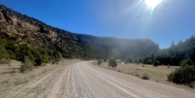
The payoff for taking the Bonita-Zuni route came a few miles into the day, when we turned west onto a pristinely-maintained gravel road and started down into Zuni Canyon. I hadn’t been sure what to expect, but Zuni Canyon proved to be a true gem in New Mexico’s sparsely-set crown of truly enchanting locales. This was especially true for a stretch of the hike that had otherwise lead us through a series of mind-bogglingly uninspiring road walks, broken only by an ankle-wrecking side trip through a lava field. I had given up on seeing anything worthwhile before checking into the Super 8 in Grants and turning on the TV.
And yet this morning found walking between exquisitely carved sandstone cliffs, grand and ornate as any piece of baroque architecture. For miles we plodded though the twists and turns of river whose only memory would be a muddy stream that might occasionally flow next to the road during the peak of the rainy season. Looking up, I could hundreds of birds flitting between the green tops of the trees anchored to the canyon walls; a refreshingly pastoral view to contrast the depressing stream of bottles and cans littering the side of the otherwise immaculately-groomed Forest Service road.
We eventually emerged from the canyon and started our walk into Grants, a small metropolis nestled at the base of Black Mesa to its northwest. As we descended, the hulking mass of Mt. Taylor loomed over the town, a giant, sprawling pyramid that dominated the view to the northeast. Austere, severe, imposing, dominating, it’s easy to see why human cultures across continents and millennia have long supposed such places to be the homes of gods. Even today, coming face to face with such a vista reminds us of our real size, our place in the scheme of things. We are motes of dust passing on the breeze over the face a world so ageless and ancient that we can’t see the motion of its breath, and so we suppose that its true nature is both permanent and motionless. The mountain is a living a thing, a sleeping giant, something that’s easy to forget in a world of air conditioning, fast food, and streaming video—but that some piece of that innate knowledge speaks to the quiet corners of our mind whenever we come around a bend in the trail to first catch a glance at something as grand and large and seemingly impossible as the stark, golden outline of Mt. Taylor against the bottomless blue of the midday desert sky.
Anyway, the last few miles into Grants sucked. The pavement beat into our tired, sore feet until each step became a rote motion, a kind of meditative shuffle we used to walk through the pain. After 16 miles, we reconnected with the Red Line, and so we were “done hiking” for the day—though we still had two and a half miles to get to our hotel, strategically located a block from the Walmart. We could have waited for a bus, but in the end walking was the faster option, and we were ready for the conveniences of town to begin as soon as possible: hot showers, laundry, a soft bed, air conditioning, fast food, and streaming video. Everything we could want or need to forget the world outside while we rested our legs and feet and hoped that by the time we left town, they would be healed.
Day 25: 11 May, 0.0 miles today, 422.2 miles total, Grants, NM
When the histories of the Covid-19 era are written, I will be curious what they have to say about this period in the American response to the pandemic, when the only prophylactic measures left in place were the ones that most conveniently suited the whims of those making the rules. The Super 8 in Grants, for example, had a sign on the front door explaining that the wearing of face masks in the building was optional; while a sign posted just a few feet away in the lobby explained to us that, much to the regret of the Super 8 and its staff, no continental breakfast would be available, since such an amenity could possibly facilitate the spread of the coronavirus.
C’est la vie, I suppose. It’s not really like the quality of the continental breakfast would even have matched as the coffee and hostess cupcakes I got from the gas station across the street—though it would at least have been free. On the whole, it was less of a disappoint than the unexpected failure of the hotel’s hot tub, which amenity Sean Meadow had made a point of conforming before we booked our room there. But not even a cold hot tub could ruin this glorious zero day, devoted to recuperating our bodies, restocking our supplies, filling and refilling our bellies, and rejuvenating our minds with a marathon of old episodes of The Office that Sean Meadow found on TV.
Day 26: 12 May, 0.0 miles today, 422.2 miles total, Grants, NM
The only thing more glorious than the zero day, of course, is the double zero—the reward to which we felt entitled after storming through the last section a day and a half faster than we’d planned to. If I had little of substance to report on yesterday, I have even less to say about this day: having completed the bulk of my town chores the day before, I barely left the plush king-sized bed given to us by the Super 8. There really isn’t much more to say about a day spent intentionally relaxing as hard as possible in preparation for a return to hiking up sandy, wind-blasted mountains with an almost complete absence of water the following day. So instead, I’d like to wander off-topic and talk a bit about routing.
The CDT, the promotional material explains, is the longest of the so-called “Triple Crown” trails, its full length clocking in at over 3,000 miles.* The thing is, though, almost no one hikes the “full length” of the Continental Divide Trail. Unlike the AT and the PCT, which are considered contiguous footpaths in and of themselves from a singular southern terminus to a singular northern terminus, the CDT is riddled along its entire length with alternate trails that are considered equally viable options for thru-hikers. For example, data compiled by the website Halfway Anywhere indicates that some 95% of reporting CDT thru-hikers opt to take the more scenic Gila River alternate trail rather than stick to the CDT Red Line. The fact that this alternate cuts some 70 miles from the total length of the hike doesn’t so much violate any of the participants’ definition of a CDT thru-hike so much as reinforces the old saying on this trail: “No two people hike the same CDT.”
It’s for this reason that I’ve always been cagey when people outside the trail community have asked me how long this trail is. The official (and imprecise) number is 3,100 miles, but I never assumed I was going to stick exclusively to the Red Line. On a trail the defining characteristic of which is choice and variety, it’s impossible to come up with a specific number ahead of time. A lot of choices are made on the fly, depending on conditions as they exist at the moment. In the end, Sean Meadow and I could have a continuous footpath** from the Mexican border to the Canadian border that could be anywhere from 2,500 miles long to 3,000. But explaining that concisely and clearly is harder than it sounds—especially with the single-pathed Appalachian Trail etched into every listener’s mind as the archetypal long-distance trail. The CDT doesn’t even have a single terminus at either end of its peregrinating length, but two in the north and two (or three, depending on whom you ask) in south.
This constant variety is part of what makes the CDT fun—in parts of New Mexico, our experience was that that detail was maybe the only fun thing about it. At every major junction, you get to choose: high route or low route? Water or wasteland? Mountains or basin? Road walk or road walk (we were still in New Mexico, after all)?
Our plan as we left Grants to resume our northward walk was to take a side trail that would lead us over (instead of around) the pyramidal peak of Mt. Taylor, another in a long series of alternates. Like every choice, we would inform ourselves as well as we could ahead of time, but always with the understanding that there was a limit on how much we could know about our route ahead of time. We could be reasonably sure of coming water sources, the steepness of the terrain, and the number of miles that lay between us and our next town; but every step forward would nonetheless carry us onward into the unknown, a world whose shape we would never really be able to appreciate until we’d walked directly into it and seen it for ourselves.
*for comparison, the PCT is 2,650 miles long, and the AT 2,190 miles—though those figures don’t do anything to describe the terrain of their respective trails
**excluding the 2.7 miles we were compelled by the Forest Service to ride in a truck